2 Formation of Arabian Shield and Thick Sedimentary Layers




Birth of Arabian Shield
(アラビア楯状地)
目次
Contents
| 1. アラビア楯状地の形成 | 1. Formation of Arabian Shield |
| 2. 堆積層の形成 | 2. Formation of Sedimentary Layers |
| 付属資料(第2章関連する地勢図) | Attached Materials (Topographic Map related to Chapter 2) |
1. アラビア楯状地の形成
1. Formation of Arabian Shield
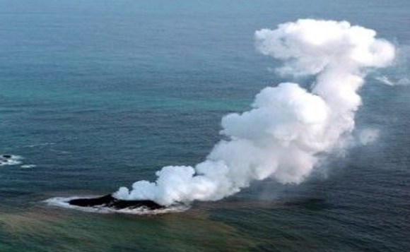
| 10億年前に沙漠の半島がアフリカ北東部沖に連なる火山性群島として初めて海面上に姿を現すまでは、アフリカ北東部の沖合には数百kmにわたって陸地は存在していませんでした。これらの群島は、小さな二つのプレートの衝突によって形成された火山性のアシール(عسير)島弧でした。約9億年前までには、最初に出現した陸地としてアシール(عسير)島弧が合体し、一つの陸塊となりました。その頃、さらに北方では、ヒジャーズ(حجاز)島弧を形成した第二次衝突が始まりました | Until one billion years ago, when Arabian Peninsula first appeared above sea surface as a volcanic archipelago off northeastern Africa, no land existed for hundreds of kilometers in that offshore region. These islands formed volcanic Asir (عسير) island arc created by collision of two small plates. By about 900 million years ago, Asir (عسير) island arc had amalgamated into a single landmass, representing first substantial land to emerge in region. Around that time, farther north, a second collision began and formed Hijaz (حجاز) island arc. |
| 現在のビーシャ(بيشة)やターイフ(الطائف)付近まで部分的に連なっていた最初の火山列は、侵食によって山頂が削られ、次第にすり減って行きました。侵食によって生じた岩屑は雨水によって運ばれ、火山列の前後にあった堆積盆を埋めました。こうして堆積した岩屑は長い時間をかけて固結し、幾種類もの堆積岩を形成しました。これらの岩石は交互に層を重ねながら形成され、深部の地層は上位地層の圧力によって圧縮され、変成作用を受けました。 | First volcanic chain, which extended in places toward present-day Bisha (بيشة) and Taif (الطائف), gradually lost its peaks through erosion. Debris produced by erosion was transported by rainfall and accumulated in sedimentary basins located on both sides of volcanic chain. Over long periods of time, these deposits consolidated and formed several kinds of sedimentary rocks. Rock layers accumulated successively, and deeper strata were compressed and metamorphosed under pressure from overlying formations. |
| 火山活動が次第に収まるに連れて、地中深くに冷えて固まった深成岩は、花崗岩、閃緑岩、その他さまざまな岩石体として地表に露出するようになりました。最終的には、それらは比較的新しい堆積岩を貫き、古い火成岩の露頭を伴う概ね平坦な景観を形成しました。 | As volcanic activity gradually subsided, plutonic rocks that had cooled and solidified deep underground became exposed at surface as bodies of granite, diorite, and various other igneous rocks. Eventually, they pierced younger sedimentary formations and produced a generally flat landscape marked by outcrops of ancient igneous rocks. |
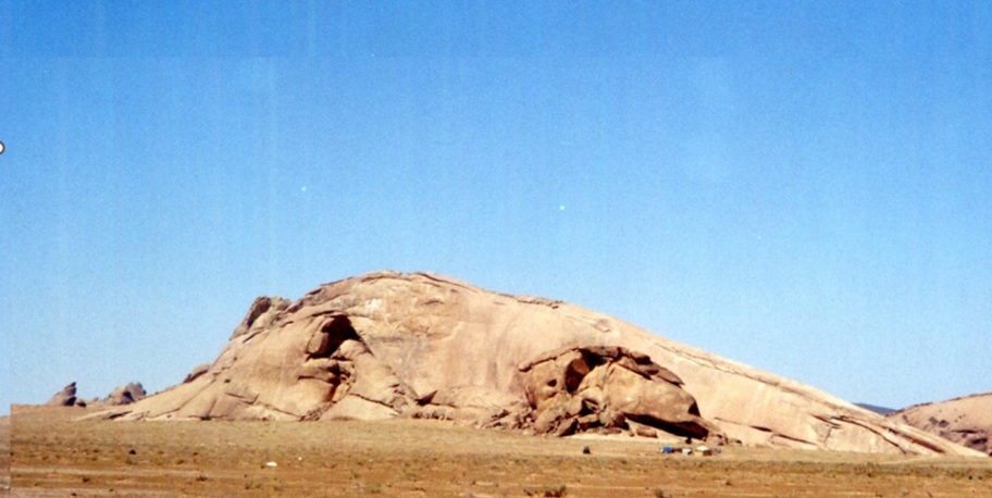
| リヤード州北部の古生層露頭 (撮影:高橋) | Paleozoic Outcrops in Northern Riyadh Province (Photo: Takahashi) |
| 同じような過程が各火山列でも繰り返されました。ヒジャーズ(حجاز)火山列は北方および東方へ向かって次々に小さなプレートと衝突し、同様の地層形成と地形進化を繰り返しました。その結果、多種多様な岩石が混在したメランジュと呼ばれる地層(岩体)が形成されました。小さなプレートが次々と付加し、一つのプレートを形成する過程は約6億4千万年前に終了しました。 | A similar process occurred in each volcanic chain. Hijaz (حجاز) volcanic chain successively collided with small plates to north and east, repeating comparable stages of stratigraphic development and topographic evolution. As a result, mélanges, geological bodies composed of many different kinds of rocks intermixed together, were formed. Process by which small plates were successively accreted into a single plate ended about 640 million years ago. |
| これらの小さなプレートは、現在では新しく形成されたプレートと構造的に一体化していますが、地殻変動が収まるまでは引き続きその影響を受けていました。非常に大規模なマグマが地下へ貫入し、ゆっくりと冷却されて花崗岩体を形成する過程で、引張力と圧縮力が新しい大地に数多くの割れ目や断層を生じさせました。また、多量の火山性溶岩が地表へ流出し、最初の山脈が侵食・破砕されて形成された堆積岩と混合しました。 | These small plates are now structurally united with newly formed plate, but they continued to be affected by tectonic activity until crustal movements subsided. Very large masses of magma intruded underground and slowly cooled to form granite bodies. During this process, tensional and compressional forces produced numerous fractures and faults in newly formed land. Large volumes of volcanic lava also flowed onto surface and mixed with sedimentary rocks derived from erosion and destruction of earliest mountain ranges. |
| 約5億5千万年前までに、第一段階におけるアラビアプレート形成は完了しました。その後、約6千万年前に紅海(البحر الأحمر)を形成した地殻変動が始まるまで、沙漠の半島では大規模な地殻変動はほとんど発生しませんでした。 | Formation of Arabian Plate during first stage had largely been completed by about 550 million years ago. After that, major tectonic activity on Arabian Peninsula remained limited until crustal movements that created Red Sea (البحر الأحمر) began about 60 million years ago. |
| このように多くの小さなプレートが付加して形成された新しいプレートは、今日ではアラビア楯状地(الدرع العربي)と呼ばれています。その基盤岩は半島西部では地表に露出しています。中央部の大部分および東部全域では、楯状地の基盤岩は堆積岩起源のより若い岩石に覆われているため、その基盤岩を見ることはできませんが、地下深くに存在しています。 | This new plate, formed through accretion of many small plates, is known today as Arabian Shield (الدرع العربي). Basement rocks are exposed at surface across western part of peninsula. Throughout most of central region and all eastern regions, basement rocks of Arabian Shield are concealed beneath younger rocks of sedimentary origin and cannot be observed directly, although they remain buried deep underground. |
2. 堆積層の形成
2. Formation of Sedimentary Layers
| この時代のアラビア楯状地は、ほとんど生物の生息しない広大で不毛な平坦地でした。初期に形成された山地や丘陵は著しい侵食を受けていました。その侵食された大地は、新しく多様な生物が繁栄する海へとゆっくり沈降して行きました。およそ5億5千万年前から、その後長期間にわたって、地球規模で海面上昇が続きました。 | Arabian Shield during this period was a vast, barren, and largely flat land inhabited by very few living organisms. Mountains and hills formed during earlier stages had already undergone extensive erosion. This eroded land gradually subsided beneath seas that supported increasingly diverse life forms. Beginning about 550 million years ago, global sea level continued to rise over a very long period. |
| 海面上昇に伴って、海はアラビア楯状地の内部へと徐々に侵入し、タブーク(تبوك)周辺の沙漠の半島(アラビア半島)北西部およびイエメン(اليمن)を含む半島南西部の一部を除いて、多くの地域が海に覆われました。約4億7千万年前までに、この浅海は数百mにも達する砂と泥の厚い堆積物を残して後退して行きました。アラビア楯状地は新しい堆積層に覆われ、その特徴は地表から見えなくなりました。 | As sea level rose, seawater progressively advanced across Arabian Shield, leaving only a few areas of northwestern Arabian Peninsula around Tabuk (تبوك) and parts of southwestern peninsula including Yemen (اليمن) above sea level. By about 470 million years ago, this shallow sea had retreated, leaving behind thick accumulations of sand and mud reaching several hundred metres in thickness. Arabian Shield became covered by these younger sedimentary deposits, and characteristics of underlying shield were no longer visible at surface. |

| アラビア楯状地が陸地として海面上に現れて間もなく、その西半分は厚い氷床に覆われました。そのため、地表に残されていた堆積物の多くは氷河による侵食を受けました。地球規模の大陸移動によってアラビア楯状地は、それまでになく南方へ運ばれました。 | Shortly after Arabian Shield emerged above sea level as a landmass, its western half became covered by a thick ice sheet. Much of sediment remaining at surface was consequently eroded by glacial activity. Continental drift on a global scale carried Arabian Shield farther south than ever before. |
| カシーム地方(منطقة القصيم)では、氷河によって運搬・堆積された未分級堆積物であるティル(till)を含む古い堆積岩が発見されており、この氷河時代の存在を物語っています。氷河は大地を削り取り、地表を覆っていた堆積物を岩粉(rock flour)、巨礫帯、その他の氷河特有の地形や堆積物へと変えていきました | In Qassim Region (منطقة القصيم), ancient sedimentary rocks containing till, an unsorted sediment transported and deposited by glaciers, provide evidence of this glacial period. Glaciers eroded land they covered, reworking sediments into rock flour, boulder fields, and other landforms and deposits characteristic of glacial environments. |
| 氷河が融解した後、大地の景観は以前とは大きく異なっていました。かつて平坦だった地形は氷河によって削られた谷によって分断され、谷底には無秩序に積み重なった巨礫や砂利が堆積していました。東部では、氷河と テチス海の間を流れる河川が、氷河の融解水を テチス海へ運びながら堆積物を侵食しました。アラビア半島最南東部に位置するオマーン(عُمان)の ジェベル・アフダル(الجبل الأخضر)に分布する最古級の堆積岩には、ティルや条線を持つ巨礫など、この古い氷河作用を示す特徴が保存されています。 | After glaciers melted, landscape became very different from its former appearance. Previously flat terrain was divided by valleys cut by glaciers, and valley floors were filled with jumbled piles of boulders and gravel. To east, rivers flowing between glaciers and Tethys Sea carried meltwater into Tethys Sea while eroding sediments. Oldest sedimentary rocks in Jebel Akhdar (الجبل الأخضر) of Oman (عُمان), located in far southeastern part of Arabian Peninsula, preserve evidence of this ancient glaciation, including till and striated boulders. |
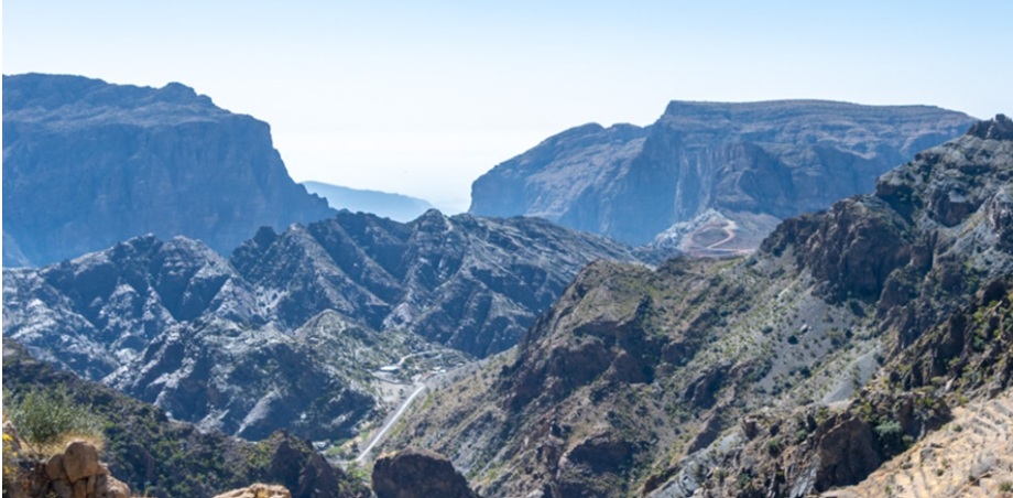
| アフダル山塊 | Akhdar Massif |
| 時とともに、アラビア楯状地(الدرع العربي)を含むゴンドワナ大陸は極地からより温暖な緯度へと移動しました。氷河は後退し、再び海が北西部を除くアラビア楯状地を覆いました。この第二回目の海進も厚い堆積層を残しました。 | Over time, Gondwana Continent, including Arabian Shield (الدرع العربي), moved from polar regions toward warmer latitudes. Glaciers retreated and seawater once again covered Arabian Shield, except for northwestern areas. This second marine transgression also left behind a thick sedimentary sequence. |
| 今回形成された堆積層は、多くの筆石類の化石を含む頁岩でした。今日では絶滅している筆石類は、約5億5千万年前から約3億5千万年前にかけて海中で繁栄した生物の一つでした。沙漠の半島が再び陸地として現れた時には、地表はこの頁岩層に覆われていました。 | Sediments deposited during this period consisted largely of shale containing numerous graptolite fossils. Graptolites, now extinct, were among marine organisms that flourished between about 550 million and 350 million years ago. When Arabian Peninsula re-emerged as land, surface was covered by this shale formation. |
| 陸地として現れた一度目との違いは、湖沼、河川、海岸周辺に植物が生育し始めたことでした。シルル紀(438-408百万年前)には植物がまず海岸付近の環境へ適応し、その後まもなく動物もこれに続いて陸上へ進出しました。 | Difference from first emergence as land was appearance of vegetation around lakes, rivers, and coastal regions. During Silurian Period (438-408 million years ago), plant life first adapted to coastal environments, and animal life soon followed in advancing onto land. |
| 沙漠の半島(アラビア半島)は十二回以上も海中に没し、その後再び陸上に現れました。しかし、陸上に現れていた期間よりも、およそ二倍に及ぶ長い期間を海中で過ごしていました。陸塊は海面変動や構造地質とは独立して、地下深部のマントル内における運動によって隆起や沈降を繰り返します。これはプレート変形や造山運動とは異なり、大きな陸塊が比較的静かに上下する現象です。沙漠の半島は、このような過程によって幾度も隆起と沈降を繰り返しました。 | Arabian Peninsula was submerged beneath sea more than twelve times and repeatedly re-emerged as land. However, total duration spent beneath sea was approximately twice as long as periods during which peninsula remained above sea level. Landmasses rise and subside through movements occurring deep within Earth’s mantle, independently of sea-level fluctuations and structural geology. This is not plate deformation or mountain-building activity, but rather a process in which large crustal blocks move vertically in a relatively quiet manner. Arabian Peninsula experienced repeated episodes of uplift and subsidence through this process. |
| 約3億7千5百万年前にも同様の現象が起こりました。海面高度そのものに大きな変化がなかったにもかかわらず、アラビア半島は乾燥した陸地として海中から隆起しました。その後の時代を代表する顕著な地質学的特徴の一つに、トゥワイク山脈(جبال طويق)がルブア・ハーリー沙漠(الربع الخالي)の砂丘へ没する最南端地域に広がる花崗岩質巨礫層があります。これらの巨礫は大小さまざまで、大きなものは直径1.5mに達します。それらの供給源と考えられる最も近い花崗岩露頭は数百km離れており、現在のイエメン(اليمن)領内に位置しています。 | A similar event occurred about 375 million years ago. Although sea level itself changed little, Arabian Peninsula rose from sea and became a dry landmass. One of most notable geological features preserved from later periods is extensive deposit of granite boulders spread across southernmost part of Tuwayq Mountains (جبال طويق), where mountain range disappears beneath dunes of Rub’ al Khali Desert (الربع الخالي). These boulders vary greatly in size, with largest reaching about 1.5 m in diameter. Closest granite outcrops considered possible sources lie several hundred kilometres away within present-day Yemen (اليمن). |
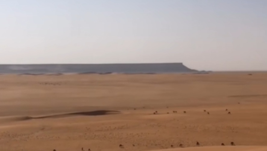
| ムンダファン(المندفن)の北部 (トゥワイク山脈南端のビデオの切り抜き) | Northern Part of Mundafan (المندفن) (Southern End of Tuwayq Mountains) |
| アラビア半島は、この過程の最終段階で再び南方の低緯度地域へ運ばれ、極地起源の氷河が半島南部へ広がりました。この地域で発見される花崗岩質の巨礫には、通常の氷河運搬で形成される典型的な条線や溝が見られません。そのため、これらの巨礫は氷河の前進時に運搬されたもの、あるいは落下石として堆積したものと考えられています。落下石とは、氷床に凍結していた、または氷河内部に取り込まれていた岩塊が、氷の融解とともに地表へ落下したものです。 | During final stage of this process, Arabian Peninsula was once again transported southward into lower latitudes, and glaciers of polar origin extended across southern part of peninsula. Granite boulders discovered in this region do not display striations or grooves normally produced during typical glacial transport. For this reason, these boulders are thought either to have been carried during glacial advance or to have been deposited as dropstones. A dropstone is a rock fragment that was frozen into an ice sheet or incorporated within a glacier and later released onto ground as ice melted. |
| オマーン(عُمان)では、涸れ谷ダイカ(وادي ضيقة)などの涸れ谷床に活発な氷河作用の証拠が残されています。氷河に取り込まれた巨礫は平坦な岩盤上に最大で深さ1mに達する平行な溝を刻み、その痕跡は現在でも涸れ谷の谷底で観察することができます。これらはオマーン山脈、すなわちハジャル山脈(جبال الحجر)に分布するカラタ氷河堆積物を特徴付ける地質学的証拠の一つです。 | In Oman (عُمان), evidence of intense glacial activity remains preserved in wadi floors such as Wadi Daiqa (وادي ضيقة). Large boulders incorporated within moving ice carved parallel grooves into flat bedrock, in some places reaching depths of up to 1 m. These features can still be observed on floors of present-day wadis. Such traces represent one of geological characteristics associated with Al Khlata glacial deposits distributed within Oman Mountains, namely Hajar Mountains (جبال الحجر). |
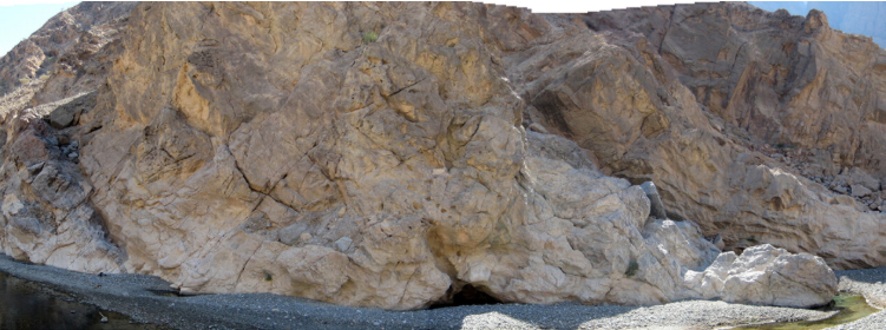
| 二畳紀(290-245百万年前)には厚い砂岩層が幾重にも形成されました。現在では、その大部分が侵食によって失われています。わずかに残された露頭からは大きな化石はほとんど発見されていませんが、岩石試料に含まれる胞子化石を顕微鏡で分析することによって、それらの年代を推定することができます。 | During Permian Period (290-245 million years ago), multiple thick sandstone formations were deposited. Most of these formations have since been removed by erosion. Few large fossils have been discovered within remaining outcrops, but ages of these rocks can be determined through microscopic analysis of fossil spores preserved within rock samples. |
| 二畳紀(290-245百万年前)の終わりに、沙漠の半島が再び海中から隆起するに伴い、植生と動物相の大規模な絶滅が起こりました。この時の隆起に際して、沙漠の半島は白色の石灰岩によって広く覆われていました。二畳紀末の大量絶滅は古生代(570-245百万年前)の終焉を画する出来事となりました。 | At end of Permian Period (290-245 million years ago), a major extinction of plant and animal life occurred as Arabian Peninsula rose once again from sea. During this uplift, much of peninsula was covered by white limestone. End-Permian mass extinction marked boundary between Paleozoic Era (570-245 million years ago) and succeeding geological age. |
| この絶滅によって多くの生物種が失われ、生態系が回復した後には、それまでとは大きく異なる生物群が地球上に出現しました。それまで海洋で圧倒的な繁栄を誇っていた三葉虫も、この時にはわずかな系統を残してほぼ姿を消しました。 | Many species disappeared during this event, and when ecosystems recovered, Earth was inhabited by biological communities markedly different from those of earlier times. Trilobites, which had previously dominated marine environments, were reduced to only a few surviving lineages before disappearing entirely. |
| 中生代(245-65百万年前)を通じて地球規模の海面上昇が進み、白亜紀(145-65百万年前)の末期には海面は最も高い水準に達しました。この時代の大部分を通じて、沙漠の半島は浅い熱帯性海域の下にありました。初めは砂岩と頁岩の間に薄い石灰岩層が堆積しましたが、その後、非常に厚い石灰岩層が形成されました。今日トゥワイク山脈(جبال طويق)の石灰岩露頭に見られる多くの成熟した化石は、こうした古代の礁性環境を示しています。 | Throughout Mesozoic Era (245-65 million years ago), global sea level continued to rise and reached its highest level during late Cretaceous Period (145-65 million years ago). For most of this era, Arabian Peninsula lay beneath a shallow tropical sea. Thin limestone beds were first deposited between layers of sandstone and shale, but these were later followed by formation of very thick limestone sequences. Many well-preserved fossils found today in limestone outcrops of Tuwayq Mountains (جبال طويق) display characteristics of ancient reef environments. |

| リヤードの西、トゥワイク山脈の石灰岩の露頭に現れている白亜紀のアンモナイトの化石、人物は、当時のサウジ人運転手です。(撮影:高橋) | A Cretaceous ammonite fossil on a limestone outcrop in Tuwayq Mountains west of Riyadh. Person shown is my Saudi driver at that time. (Photo: Takahashi) |
| 最も初期の海進は、一般的にアラビア半島西部の最も内陸部まで達したと考えられています。カンブリア紀(570-510百万年前)およびその他の古生代堆積層は、アラビア半島南部および北部の双方で、Red Sea(البحر الأحمر)に最も近い地域に分布しています。これら古生代堆積層の痕跡は、その後の長期にわたる侵食作用によって、アラビア楯状地(الدرع العربي)中央部では確認されていません。 | Earliest marine transgression is generally considered to have penetrated farthest into western Arabian Peninsula. Cambrian (570-510 million years ago) and other Paleozoic sedimentary formations occur closest to Red Sea (البحر الأحمر) in both northern and southern parts of peninsula. Traces of these Paleozoic deposits have not been preserved within central Arabian Shield (الدرع العربي) because of prolonged erosion during subsequent geological periods. |
| 後期古生代および中生代の堆積層は、アラビア半島中央部を1000km以上にわたり弧状に分布し、北部と南部の露頭を結ぶ線よりもさらに西方へ広がっていたと考えられています。アフィフ(عفيف)近郊のリヤード(الرياض)・メッカ(مكة)旧街道沿いでは、これらの地層は最も近い中生代海成堆積物の露頭より約200km西方に分布しています。 | Late Paleozoic and Mesozoic sedimentary formations extend in a broad arc for more than 1,000 km across central Arabian Peninsula and probably reached farther west than line connecting northern and southern outcrops. Near Afif (عفيف), along old road between Riyadh (الرياض) and Mecca (مكة), these formations occur approximately 200 km west of nearest outcrops of Mesozoic marine sediments. |
| トゥワイク崖地(جرف طويق)から東方へ向かって地表は緩やかに傾斜しています。崖地とダフナー砂丘帯(الدهناء)との間に露出する岩石は、海成起源の薄い砂岩層を除くと、そのほとんどが石灰岩によって構成されています。これらの石灰岩層は、ジュラ紀(208-145百万年前)から白亜紀(145-65百万年前)にかけて連続的に堆積した10の主要な層から構成されています。東方への緩やかな地層傾斜と侵食作用によって、各層は短い距離の間に順次地表へ露出し、その後さらに若い地層によって覆われています。 | Land surface slopes gradually eastward from Tuwayq Escarpment (جرف طويق). Except for occasional thin sandstone beds of marine origin, exposed rocks between escarpment and Dahna Dune Belt (الدهناء) consist almost entirely of limestone. These limestone sequences comprise ten major layers deposited successively from Jurassic Period (208-145 million years ago) through Cretaceous Period (145-65 million years ago). Because of gentle eastward dip and continuing erosion, each layer becomes exposed at surface before passing beneath progressively younger strata. |
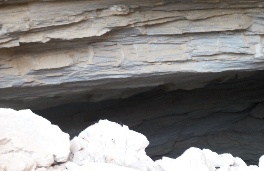
| 鍾乳洞ダハル・ヒートの入り口(撮影:高橋) | Entrance to Dahl Hit (a limestone cave) (Photo: Takahashi) |
| 石灰岩が卓越する地域における顕著な例外の一つが、ハルジュ(الخرج)からリヤード(الرياض)へ向かう途中にあるダハル・ヒート(دحل هيت)です。ここでは地表に無水石膏などの蒸発岩が露出しています。(注:ダハル・ヒートはハルジュ南方約80km付近にも存在しますが、ここで述べている場所ではありません。) | One notable exception within predominantly limestone terrain is Dahl Hit (دحل هيت), located between Al Kharj (الخرج) and Riyadh (الرياض). Evaporite rocks, including anhydrite, are exposed at surface in this area. (Note: Another Dahl Hit exists about 80 km south of Al Kharj, but it is not location discussed here.) |
| この真珠色を帯びた灰色の岩石には、やや黒ずんだシミが認められます。このシミは1938年に ARAMCO の地質学者によってタールの滲出として確認された油兆であり、アラビア半島東部の油層構造を解明する重要な手掛かりとなりました。その後、東部州(المنطقة الشرقية)においてこの層準を追跡した結果、この国の莫大な石油資源へとつながる最初の出油が得られました。 | These pearl-grey rocks contain darker stains. In 1938, geologists of ARAMCO recognized these stains as surface indications of petroleum and used them as an important clue in understanding oil-bearing structures of eastern Arabian Peninsula. Subsequent exploration of this stratigraphic horizon in Eastern Province (المنطقة الشرقية) led to first commercial oil discoveries associated with vast petroleum reserves of country. |
| アラビア半島の多くの油田はジュラ紀地層中に存在しています。トゥワイク崖地(جرف طويق)とリヤードの間に露出する石灰岩は、ダハル・ヒート(دحل هيت)に露出する無水石膏層よりもやや古い地層です。これらの地層は東方へ行くに従って次第に深く埋没し、増大する圧力と温度の影響を受けて石灰岩中の有機物から石油が生成されました。 | Many oil fields of Arabian Peninsula occur within Jurassic formations. Limestone exposed between Tuwayq Escarpment (جرف طويق) and Riyadh is slightly older than anhydrite-bearing strata exposed at Dahl Hit (دحل هيت). Farther east, these formations become progressively buried and are subjected to increasing pressure and temperature. Under these conditions, organic material contained within limestone generated petroleum. |
| 生成された石油は、その後アラビア半島がアジア大陸と衝突した際の圧縮作用によって形成された背斜構造の下部へ集積しました。イラク(العراق)南部およびイラン(إيران)南部の油田も、同じ時代の類似した褶曲構造内に存在しています。アジア大陸とアラビア半島の衝突によって形成されたこれらの褶曲帯には、世界の原油埋蔵量の大きな部分が集中しています。 | Oil subsequently accumulated beneath anticlinal structures formed by compressional forces associated with collision between Arabian Peninsula and Asian continent. Oil fields in southern Iraq (العراق) and southern Iran (إيران) occur within similar folded structures of comparable age. These fold belts, created by collision of Arabian Peninsula and Asian continent, contain a substantial proportion of world’s petroleum resources. |
| 中生代の終わりが近づくにつれて、デボン紀(408-360百万年前)の時と同様に半島中央部は再び隆起しました。海岸線は陸地の隆起に先立って東方へ後退し、それ以後、海岸線がアラビア半島内陸深くまで進入することはありませんでした。 | As end of Mesozoic Era approached, central part of peninsula was uplifted once again, much as it had been during Devonian Period (408-360 million years ago). Coastline retreated eastward before uplift reached its maximum extent, and since that time seawater has never advanced far into interior of Arabian Peninsula. |
| その後も海岸線は前進と後退を繰り返し、現在のアラビア半島東部にあたる地域が何度も海に覆われましたが、海岸線がダフナー砂丘帯(الدهناء)を越えてさらに西方へ達することはありませんでした。中央部および西部は、その後も侵食と削剥を受け続けましたが、新たな海成堆積層は形成されず、古い岩層に由来する陸成堆積層が発達する特異な地域となりました。 | Although coastlines continued to advance and retreat and parts of present-day eastern Arabia were repeatedly submerged, marine waters never extended west beyond Dahna Dune Belt (الدهناء). Central and western regions continued to experience erosion and denudation, but no major marine sedimentary sequences were deposited thereafter. Instead, these regions became characterized by terrestrial deposits derived from erosion of older rock formations. |
付属資料(第2章関連する地勢図)
Attached Materials (Topographic Map related to Chapter 2)
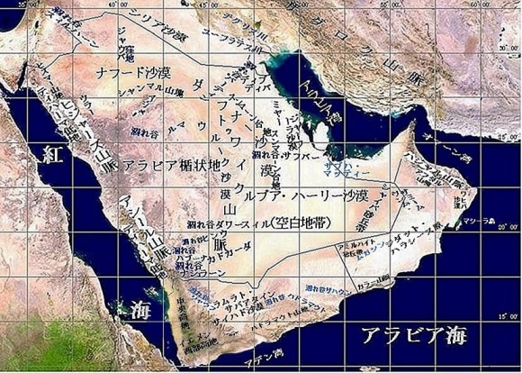
第2章関連地勢図

Topographic Map related to Chapter 2

