8.5 Unique terrains and locations of Rub’ al Khali

目次
Contents
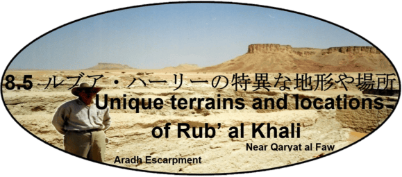
- アラダ崖地
جرف عردة
1. Aradh Escarpment
| ルブア・ハーリー沙漠(الربع الخالي)南西部では、西側に石灰岩の隆起した崖地が続いています。これはアラビア半島の脊稜を成すトゥワイク山脈(جبال طويق)の南方延長部に当たりますが、涸れ谷ヒンウ(وادي الحنو)の上流部であるシャイーブ・ファーウ(شعيب الفاو)より南では細く狭くなるため、山脈ではなく崖地として扱われています。さらに南のハシュム・グラーブ(خشم غراب)(スルターナ(سلطانة))付近でやや東に向きを変え、その後は砂の中に消えています。ウィルフレッド・セシジャーはこの崖地をアラド(جرف عردة)と呼んでいました。 | Southwestern Rub‘ al Khali (الربع الخالي) is bordered on its western side by an uplifted limestone escarpment. It is a south extension of Jebel Tuwayq (جبال طويق), forming spine of Arabian Peninsula. South of Sha‘ib al Faw (شعيب الفاو), upstream of Wadi al Hinw (وادي الحنو), this ridge becomes so narrow that it is regarded as an escarpment rather than a mountain range. Further south of Khashm Ghurab (خشم غراب) (Sultanah) (سلطانة), it turns slightly eastward and then disappears into vast sand. Wilfred Thesiger called this escarpment Aradh (جرف عردة). |
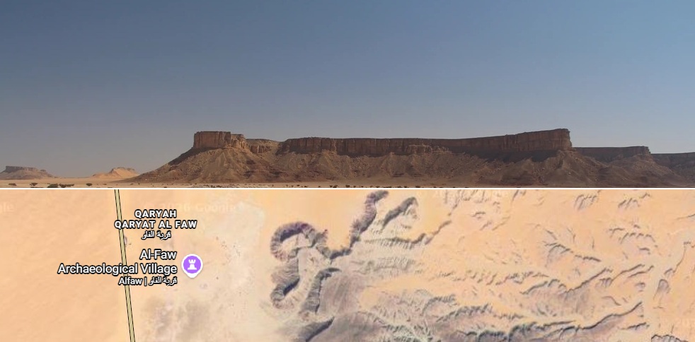
Opposite Side of Aradh Escarpment Observed by Wilfred Thesiger (UNESCO World Heritage Convention)
Google Maps
2. ウンム・ハディダ窪地
أم الحديدة
2. Umm al-Hadidah Craters
| フィルビーは1933年に出版した著書『ルブア・ハーリー沙漠』の中で、自身が調査したルブア・ハーリー沙漠(الربع الخالي)について記述しています。 | St John Philby published his book Rub’ al Khali in 1933, describing Rub’ al Khali (الربع الخالي), which he investigated |
| この書物の中で彼は、「1863年または1891年に発生し、南東へ向かって進み、リヤード(رياض)上空を通過したと報告された火の玉」についても触れています。 | In this book, he also mentions “a fireball reported to have occurred in 1863 or 1891, travelled toward southeast and passed over Riyadh (رياض).” |
| 現在では、この火の玉は鉄隕石であったと考えられています。ワバール窪地(فوهة الوابر)の北西約25 kmに位置するウンム・ハディダ(أم الحديدة、「鉄の母」の意)では、ワバール隕石と同一の IIIA 型オクタヘドライト鉄隕石片が発見されています。 | This fireball is now considered to have been an iron meteorite. At Umm al-Hadidah (أم الحديدة, “Mother of Iron”), located about 25 km northwest of Wabar crater (فوهة الوابر), fragments of a Type IIIA octahedrite identical to Wabar meteorite fragments have been found. |
| これらの破片は、ワバール衝突体の飛来経路上で分離・散布したものと解釈されており、隕石が北西から南東へ飛来したことを示す証拠の一つとされています。主衝突地点はワバール窪地と考えられています。(詳細はワバール窪地の項を参照してください。) | These fragments are interpreted as debris separated and scattered along Wabar impactor trajectory and are regarded as evidence that this meteorite approached from northwest toward southeast. Wabar crater is considered to be its principal impact site. (See Wabar crater for further details.) |
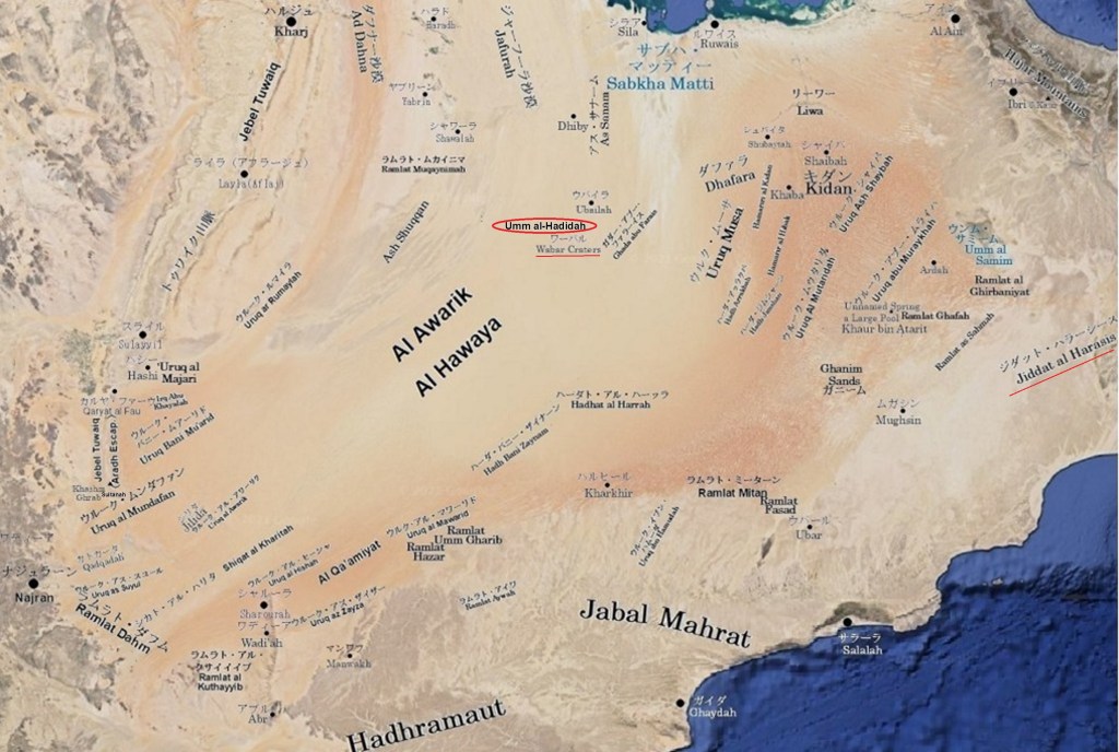
Umm al-Hadidah Craters drawn by Takahashi on Google Maps
3. カドカーダ
القضقاضة
3. Al Qadqadah
| アシール山地(جبال عسير)から空白地帯へと流れ下る涸れ谷ハブーナ(وادي حبونة)の古い河床は、小さな玉石や砂利の原を意味するカドカーダ(القضقاضة)と呼ばれています。この涸れ谷の上流域にあたるアシール山中には、現在でも大きなタマリスク(ギョリュウ)(أثل)の群生が残っています。ハブーナ涸れ谷の豊かな植生は、カドカーダ形成と何らかの関係があったのかもしれません。 | Wadi Habunah (وادي حبونة) flows from Asir mountains (جبال عسير) into Rub‘ al Khali (الربع الخالي). Its old riverbed is called Al Qadqadah (القضقاضة), meaning a field of small boulders and gravels. In upper reaches of this wadi, large Tamarisk (أثل) colonies still remain today. Such richness of Wadi Habunah may have contributed to formation of Al Qadqadah. |
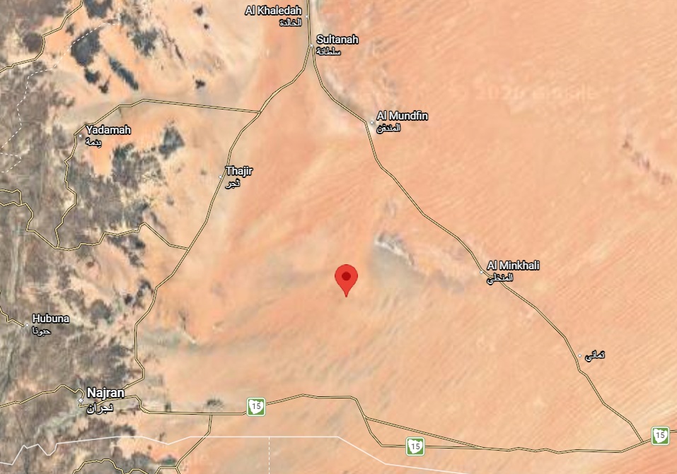
Approximate Location of Al Qadqadah (Google Maps)
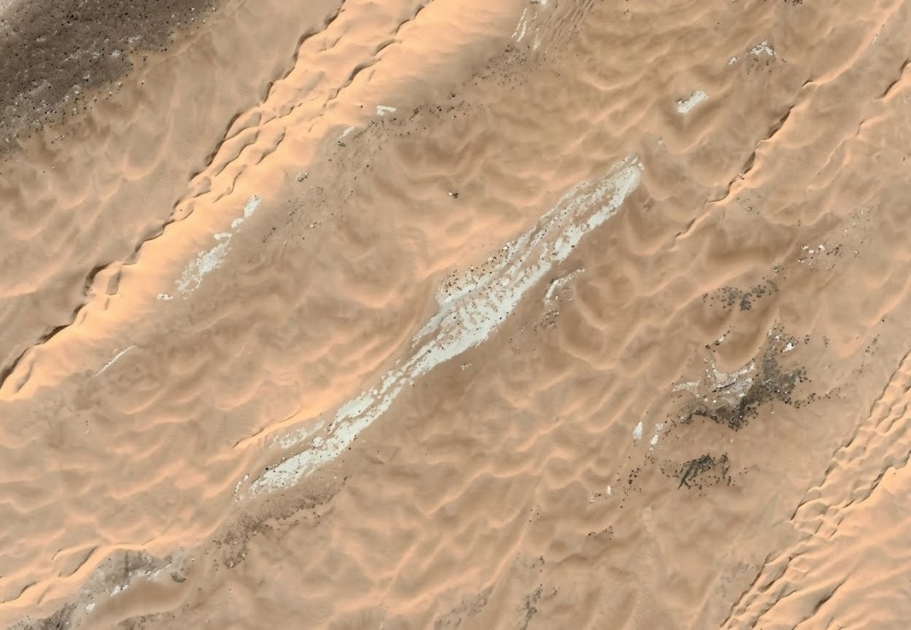
Terrain Appearing to be Al Qadqadah (Google Maps)
4. サブハ・ハマー
سبخة الحمر
4. SaAl Hammarbkhat
| このサブハは涸れ谷サフバー(وادي السهباء)の河口域に位置し、サブハ・マッティー(سبخة مطي)の西30 km、バサ(البطحاء)の南30 kmに広がります。 | It is a sabkha that spreads 30 km west of Sabkha Mutti (سبخة مطي) and 30 km south of Al Batha (البطحاء), located in estuary area of Wadi as‑Sahba (وادي السهباء). |
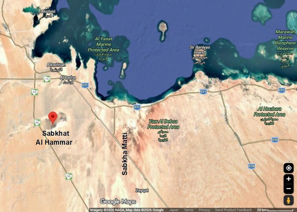
Location Map of Sabkhat Al Hammar (Google Maps)
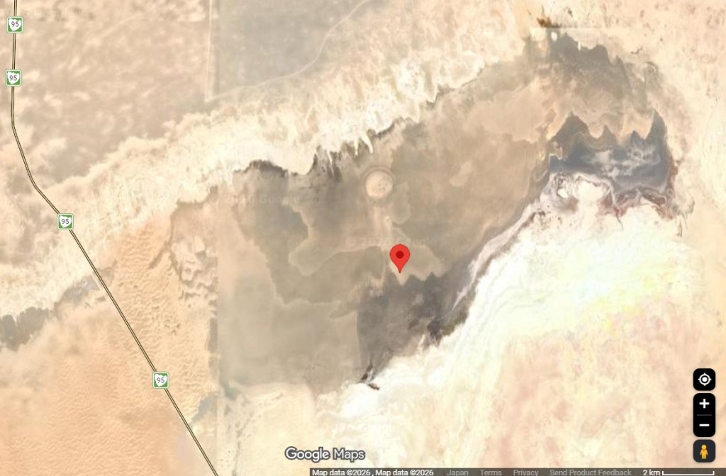
Sabkhat Al Hammar (Google Maps)
5. サブハ・マッティー
سبخة مطي
5. Sabkha Matti
| サブハ・マッティー(سبخة مطي)は、アラブ首長国連邦とサウジアラビアの国境地帯で、カタールに近いアラビア湾岸に広がっています。また、涸れ谷サフバー(وادي السهباء)の河口域にも広がっています。マッティーという語はイラクでは「驢馬」を意味しますが、このサブハが予想以上に内陸深くまで入り込んでいるため、この地域のベドウイン(بدويون)は「ゴムのように伸びる」という意味で用いているようです。 | Sabkha Matti (سبخة مطي) spreads across border area near Qatar between United Arab Emirates and Saudi Arabia on Arabian Gulf coast. It also occupies estuary area of Wadi as‑Sahba (وادي السهباء). In Iraq, Matti means donkey, but Bedouin (بدويون) in this region use it to mean that it stretches like rubber, because this sabkha extends far inland. |
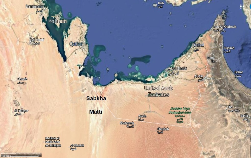
Location Map of Sabkhah Matti (Google Maps)
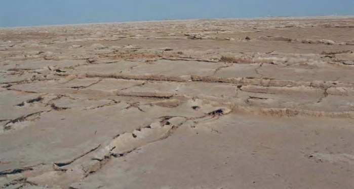
Polygonal Salt Crust at Sabkha Matti Surface (Saltwork Consultants)
6. ジダット・アル・ハラシース
جدة الحراسيس
6. Jiddat al-Harasis
| ジダット・アル=ハラシース(جدة الحراسيس)は、オマーン南部の中央部に位置し、標高100〜150 mの範囲で約27,000 km2に広がる石灰岩台地です。詳細は「6 砂丘地帯」を参照してください。 | Jiddat al‑Harasis (جدة الحراسيس) is a limestone plateau located in central southern Oman, covering approximately 27,000 km2 at an elevation of 100 to 150 m. See “6 Dunes” for more information. |
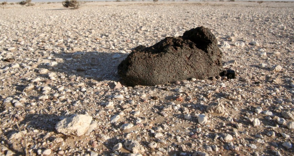
Jiddat al-Harasis (ART&MET Meteorites Collection )
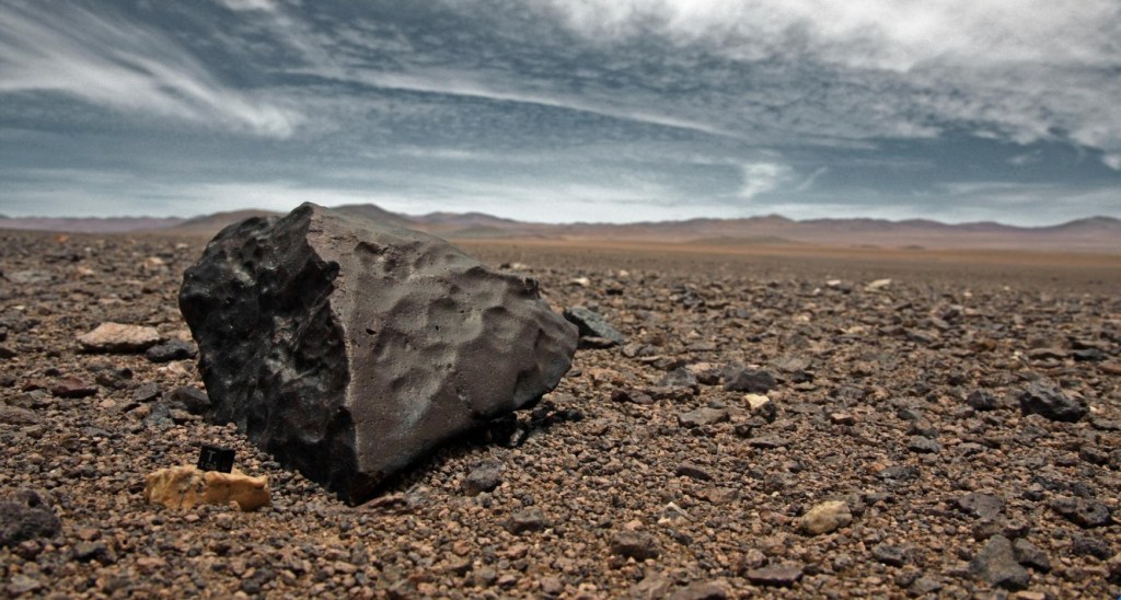
Jiddat al-Harasis #2 (ART&MET Meteorites Collection )
7. ジリダ
7. Jilida
| 涸れ谷ハブーナ(وادي حبونة)が空白地帯へと流れ込み、その結果として形成されたのがカドカーダ(القضقاضة)であり、ジリダはそのさらに下流域に当たります。平原ジリダでは、風によって磨かれた流紋岩、斑岩、碧玉、花崗岩などの岩片が、礫岩層を覆う固い砂の中にモザイク模様を作り出しています。 | Wadi Habunah (وادي حبونة) flowed into Rub‘ al Khali (الربع الخالي) and formed Al Qadqadah (القضقاضة). Jilida is further downstream of Al Qadqadah. In ex‑riverbed Jilida, wind polished fragments of rhyolite, porphyry, jasper, granite, and other rocks, creating a mosaic pattern in hard sand overlying gravel bed. |
| ウィルフレッド・セシジャー(Wilfred Thesiger)による1948年の第二回ルブアルハリ砂漠(الربع الخالي)横断の記録からすると、ジリダ(Jilida)は位置図の赤い円で囲まれた、砂丘列のない広い平原地帯であるとほぼ確定できます。 | Based on records from Wilfred Thesiger’s second crossing of Rub‘ al Khali (الربع الخالي) in 1948, Jilida can be almost certainly identified as a wide plain without dune ridges, circled in red on the location map. |
| 〔注〕ジリダ (Jilida) は Wilfred Thesiger と St. John Philby の記録に掲載されていますが、アラビア語表記は不明です。 | Note: Jilida is recorded by Wilfred Thesiger and St. John Philby, but its Arabic spelling is unknown. |
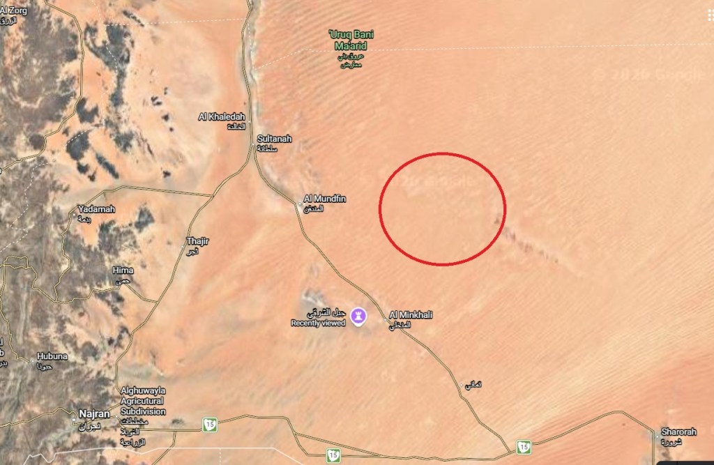
Location Map of Jilida
8. ハシュム・クムダ
خشم كمدة
8. Khashm al Kumdah
| トゥワイク山脈(جبل طويق)を涸れ谷ワーディー・アッ=ダワースィル(وادي الدواسر)が切り通して形成した南側の崖の端には、東から西へ向かってハシュム・クムダ(خشم كمدة)と、ハシュム・カザフ(Khashm al Kazafu)が並んでいます。 | Khashm al Kumdah (خشم كمدة) and Khashm al Kazafu stand on southern cliff edges carved out where Wadi al Dawasir (وادي الدواسر) cut through Jebel Tuwaiq (جبل طويق). |
| この崖は、長い年月をかけてワーディー・アッ=ダワースィルが東へ流れ下る過程で削り取られた結果として生まれた地形です。 | These two cliff points line up from east to west along this dramatic break created by long‑term erosion as Wadi al Dawasir once flowed eastward across this region. |
| 〔注〕ハシュム・カザフ (Khashm al Kazafu) のアラビア語表記は不明です。 | Note Arabic spelling of Khashm al Kazafu is unknown. |
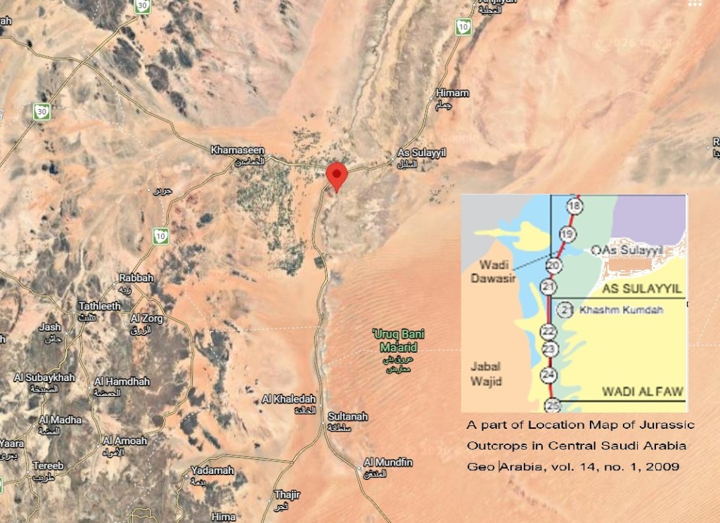
Location Map of Khashm Kumdah (Google Maps)
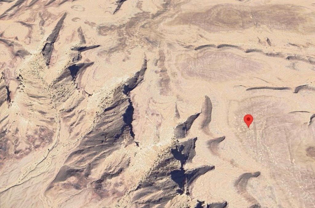
Oblique View of Wadi ad Dawasir from above Khashm Kumdah (Google Maps)
9. ハシュム・グラーブ
خشم غراب
9. Khashm Ghurab
| 涸れ谷ダワースィル地方のグバイシュ丁字路(الغبيش)(現在のマフラク・ナジュラーン(مفرق نجران))から南へ180 kmにある二叉分岐スルターナ(سلطانة)の東に位置するピークが、ハシュム・グラーブ(خشم غراب)です。 この二叉分岐では、道路がルブア・ハーリー沙漠南部の軍事都市シャルーラ(شرورة)へ向かう道と、ナジュラーン(نجران)へ向かう道に分かれます。 この分岐点の名称が Google 地図に掲載される以前、私はここを ハシュム・グラーブ と呼んでいました。 | Khashm Ghurab (خشم غراب) is a peak located east of forked point Sultanah (سلطانة) which is located at 180 km south of junction Ghubaish (الغبيش) (present Mafraq Najran (مفرق نجران) ) in Wadi al Dawasir region (منطقة وادي الدواسر). At this fork, road branches into a route toward Sharourah (شرورة) and another toward Najran (نجران). Before this junction name appeared on Google Maps, I used to call this place Khashm Ghurab. |
| ハシュム・クムダ(خشم كمدة)および ハシュム・グラーブ(خشم غراب)の画像は入手できないため、「ハシュム(山嘴:鋭く突き出した崖の角)」の一例として、リヤード(رياض)から新メッカ街道を西へ下る長い坂の南側に位置する トゥワイク(طويق)山脈の支脈の画像を掲載しました。 | Since images of Khashm Kumdah (خشم كمدة) and Khashm Ghurab (خشم غراب) are unavailable, an image of a spur of Tuwaiq (طويق) Mountains, located on southern side of a long slope descending west from Riyadh (رياض) along New Makkah Road, has been posted as an example of Khashm (spur: sharply protruding cliff corner). |
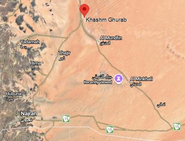
Location Map of Khashm Ghurab
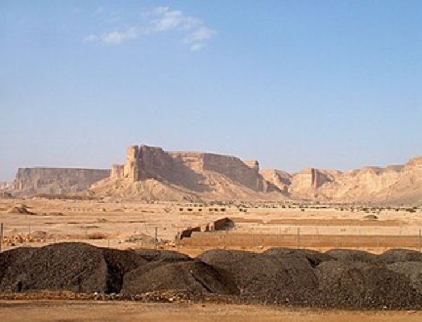
A sample of Khashm (Wikipedia)
10. ハシュム・ハヤール
خشم الهيال
10. Khashm al Hayyal
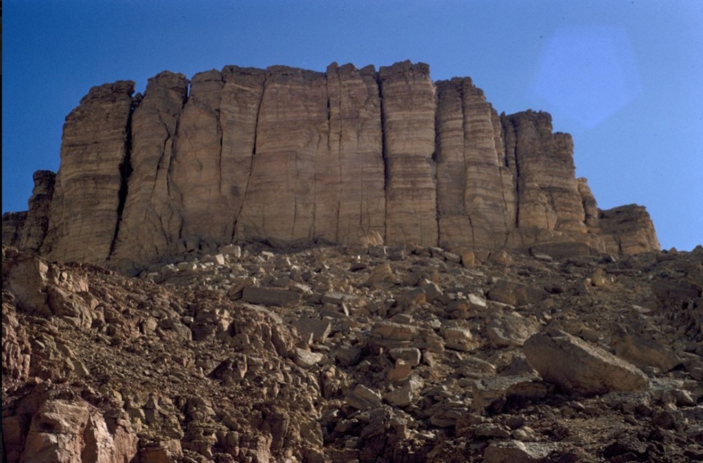
| トゥワイク山脈(جبل طويق)をカルヤ・ファーウ(قرية الفاو)で、シャイーブ・ファーウ(شعيب الفاو)が切り通して形成した山脈南部分(アラダ崖地(جرف عردة))の北端に位置するピークが、ハシュム・ハヤール (خشم الهيال) です。 | Khashm al Hayyal (خشم الهيال) is a peak on northern edge of Aradh Escarpment (جرف عردة), a southern section of Jebel Tuwaiq (جبل طويق) carved out where Sha’ib al Faw (شعيب الفاو) cuts through the range near Qaryat al Faw (قرية الفاو). Aradh Escarpment (جرف عردة) extends south from this point. |
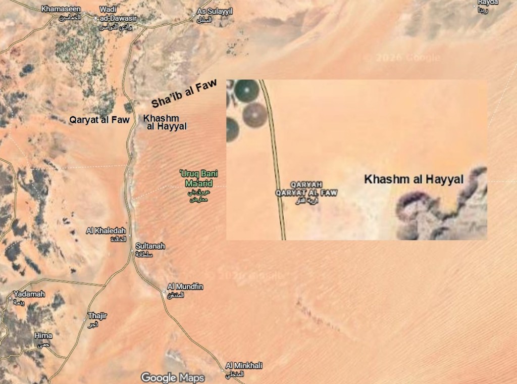
Location Map of Khashm al Hayyal (Google Maps)
Khashm al Hayyal (University of Wisconsin Milwaukee’s Libraries)
11. ワバール窪地
فوهة الوابر
11. Wabar Crater
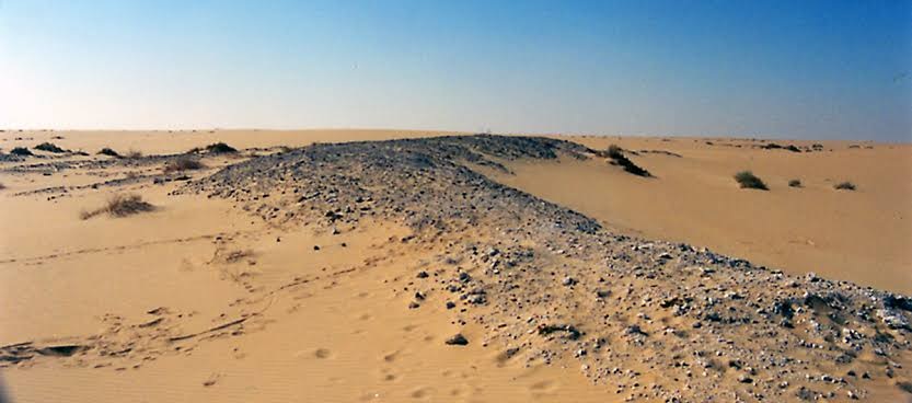
| 1932年2月、謎の都市ウバールを探索していた St. ジョン・フィルビーは、音訳上ウバール(وبار)をワバールと理解していたため、ベドウィン(بدويون)が「鉄の場所(ハディダ(الحديد))」と呼んでいた古代の住居遺跡こそがウバールであると考え、そこへ遠征しました。 | In February 1932, St John Philby was exploring mysterious city Ubar. Philby believed that Ubar (وبار) was identical to Wabar in transliteration, so he traveled to ancient dwelling sites called “Iron Place” — Al Hadida (الحديد) — by bedouins (بدويون). |
| 過酷な沙漠を長く旅したものの、ウバール自体は発見できませんでした。しかし、白い砂岩、黒いインパクタイト、鉄隕石が散乱し、5つの隕石衝突窪地をもつ広大な隕石衝突跡を発見しました。 フィルビー自身は当初これを火口と考えていましたが、英国へ持ち帰った岩石資料を大英博物館が分析した結果、隕石衝突跡であることが判明しました。フィルビーはその詳細を著書『ルブア・ハーリー沙漠』(1933年)に記述しています。 | After a long journey across harsh desert, Philby could not find Ubar itself, but he discovered a wide impact area scattered with white sandstone, black impactite, and iron meteorite fragments, including five meteorite craters. Philby initially thought this area was volcanic, yet analysis by British Museum on rock samples he brought back to England revealed a meteorite impact origin. Philby described these findings in his book Rub’ al Khali (1933). |
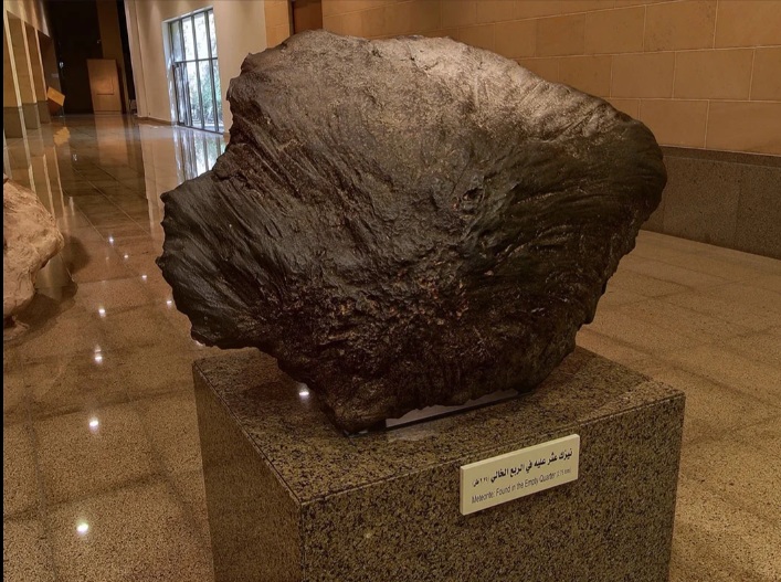
| その後、1937年に Aramco、1966年に Aramco と National Geographic、1982年にも Aramco が調査を行い、National Geographic の Thomas J. Abercrombie は 2.2 t の巨大な鉄隕石を発見して持ち帰りました。これは現在、サウジアラビア国立博物館に展示されています。 さらに、1994〜1995年には Zahid Tractor の後援で Dr. Jeffrey C. Wynn による調査も行われました。 (ウンム・ハディダも参照してください。) | Later, Aramco surveyed this site in 1937, Aramco and National Geographic again in 1966, and Aramco once more in 1982. Thomas J. Abercrombie of National Geographic found and transported a huge 2.2 t iron meteorite, now displayed at National Museum of Saudi Arabia. From 1994 to 1995, Dr. Jeffrey C. Wynn also investigated this area under sponsorship of Zahid Tractor. (See also Umm al‑Hadidah.) |
Wabar Crater (Alchetron)
Wabar Meteorite displayed at National Museum in Riyadh (Saudipedia)

