
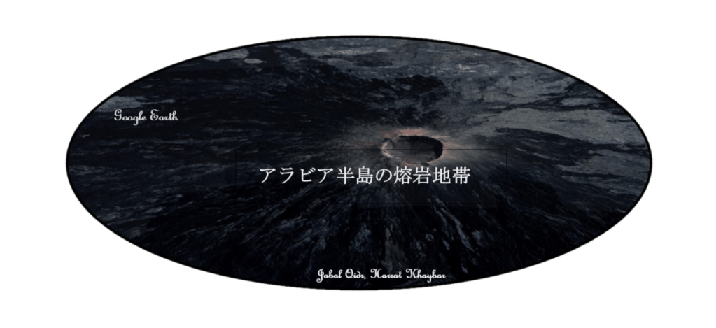
Lava Zones of the Arabian Peninsula

目次(Index)
| ハッラ熔岩地帯(ラジル熔岩地帯) | Al Harrah (Harrat Al Rajil) | الحرة |
| ラハー熔岩地帯 | Harrat ar Raha | حرة الرحا |
| ウワイリド熔岩地帯 | Harrat Uwayrid | حرة عويرض |
| グワイタート熔岩地帯 | Harrat at Ghuwaytat | حرة الغويطات |
| フタイム熔岩地帯 | Harrat Hutaym | حرة هتيم |
| ザビン熔岩地帯 | Harrat az Zabin | حرة الزبن |
| ハイバル熔岩地帯 | Harrat Khaybar | حرة خيبر |
| ルーナイル熔岩地帯(シャーカ熔岩地帯) | Harrat Lunayyir (Harrah Al-Shaqah) | حرة لونير |
| ナーイマ熔岩地帯 | Harrat an Naimah | حارة الناعمة |
| キシュブ熔岩地帯 | Harrat Kishb | حرة كشب |
| ラハート熔岩地帯 | Harrat Rahat | حرة رهاط |
| クファイフ熔岩地帯 | Harrat Qufayf | حرة القفيف |
| ハダン熔岩地帯 | Harrat Hadan | حرة حضن |
| ナワースィフ熔岩地帯 | Harrat Nawasif | حرة نواصف |
| ビクーム熔岩地帯 | Harrat al Buqum | حرة البقوم |
| ハッラ・ダッム | Harrat Ad Damm | حارة الد م |
| ハッラ・シャマー | Harrat Shama | حارة شما |
| ビルク熔岩地帯 | Harrat al Birk | حرة البرك |
| シラート熔岩地帯 | Harrat as Sirat | |
| ティハーマ・アシール熔岩地帯 | Harrat Tihama Asir | |
| イエメン熔岩地帯 | Harrat Yemen | |
| アターグ熔岩地帯 | Harrat Atag |
序文
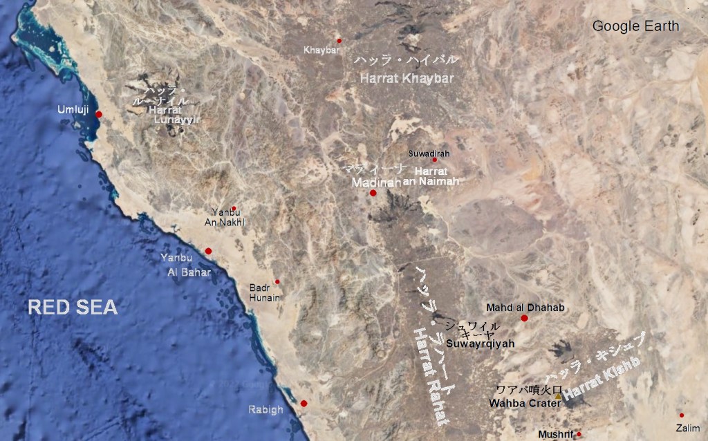
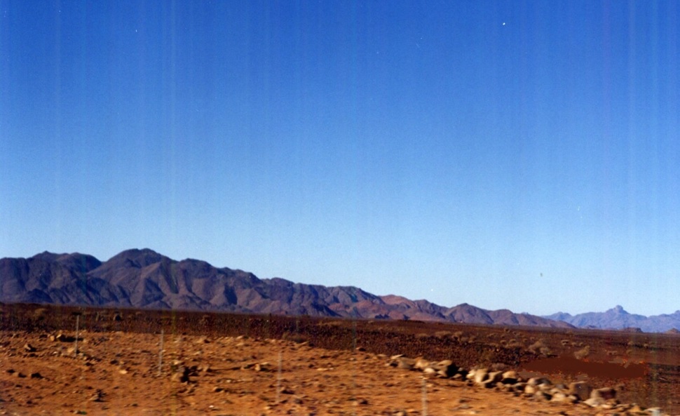
サラワート山脈とその両側には、大小15以上の熔岩地帯が南北にならんでいます。その内の主なものには、ハッラ熔岩地帯(Harrat Al Harrah)(ラジル熔岩地帯(Harrat Al Rajil))、ハイバル熔岩地帯(Harrat Khaybar)、ラハート熔岩地帯(Harrat Rahat)、ナワースィフ・ビクーム熔岩地帯(Harrat Nawasif-Buqum)、ビルク熔岩地帯(Harrat al Birk)イエメン熔岩地帯(Harrat Yemen)などがあります。
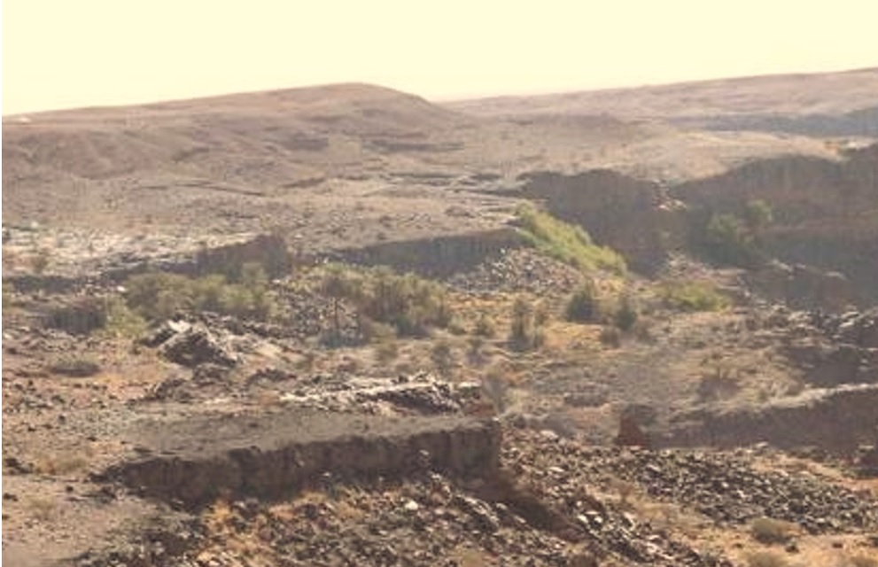
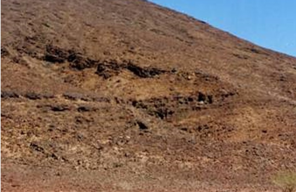
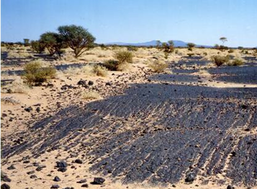
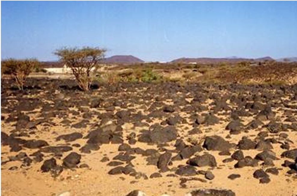
熔岩地帯は火山岩(Volcanic Rocks)、熔岩(Lava)、火山灰(Ash)で覆われており、火山がこの地域の至る所に散らばっています。現在、これらの火山の活動は、限られています。それでも、ルーナイル熔岩地帯(Harrat Lunayyir)の8キロの及ぶ割れ目(crevasse)や、小さいながらハーイル(Hayil)南にあるターバ火口(Tabah Creater)の割れ目(crevasse)等が一般に知られています。また、ティハーマ低地(Tihama)では、1キロ四方にも満たない小さな熔岩地帯が良く見受けられます。それらの内で、白い水蒸気の様な煙を出しているところは、少なくありません。火山の多くは、高くも大きくもありませんが、ワフバ火口(Wahbah Crater or Maqla Tamia)は、火口の周囲が11kmもあります。ワフバ火口はその大きさばかりでは無く、その火口の底に湖の様に堆積した白いリン酸ナトリウム沈殿物(white sodium phosphate crystals)や火口周囲の緑の豊かさでも有名です。粘性が低い為に熔岩は非常に長い距離を容易く流れ、広い範囲を薄い熔岩膜で覆っています。この薄い熔岩膜は土壌の水分の蒸発、地温上昇や肥料分流出を抑制抑えるマルチ効果(Mulching effects)があるので、熔岩地帯では多くの植生が育っているのが見られます。また、その植生に依存する集落も散らばっています。
Introduction
The Sarawat Mountains and their flanks are lined with more than 15 large and small lava fields running north-south. The main ones among them are the Harrat Al Harrah, the Harrat Khaybar, Harrat Rahat, Harrat Nawasif-Buqum, Harrat al Birk, Harrat Yemen,etc.
The lava areas are covered with volcanic rocks, lava and ash, and volcanoes are scattered throughout those lava fields. Currently, the activity of these volcanoes is limited, however the 8-kilometre crevasse in the Harrat Lunayyir and the small crevasse in the Tabah Creater south of Hayil are commonly known. In the Tihama lowland, small lava areas less than 1 km square are often seen. Among them, there are not a few places that emit smoke like white water vapor. Many of the volcanoes are neither high nor large, but the Wahbah Crater or Maqla Tamia is surrounded with 11 km crater wall. Wakhba Crater is famous not only for its size, but also for the white sodium phosphate crystals deposited like a lake at the bottom of the crater and the richness of greenery around the crater. Due to its low viscosity, the lava flows easily over very long distances and covers a wide area with a thin lava membrane. This thin lava membrane has mulching effects that suppress evaporation of soil moisture, soil temperature rise and fertilizer runoff, therefore many vegetation can be seen growing in the lava area. It is also scattered with settlements that depend on this vegetation.
リンクの無い項目 (Items without links)
グワイタート熔岩地帯 Harrat at Ghuwaytat حرة الغويطات
ハッラ・フタイム北部でハーイル西南西90km付近に広がる熔岩地帯A lava zone spreading 90km west-southwest of Ha’il and to connects to the northern Harrat Hutaym.
フタイム熔岩地帯 Harrat Hutaym حرة هتيم
ハーイル州南西部に有り、州境のマディーナ・ムナッワラ州側にあるハッラ・ハイバルと南西部を接し、北部はハッラ・グワイタートと接している。
A lava zone located in the southwestern Hail Province, and its southwestern part connects to Harrat Khaybar in the Madinah Munawwarah province, and its northern part does to Harrat at Ghuwaytat.
ザビン熔岩地帯 Harrat az Zabin حرة الزبن
ウラー南南西60km付近から南東に涸れ谷ジズルと涸れ谷ハムドの合流地に向かって南東に延びている熔岩地帯
A lava zone extending southeast from 60km south-southwest of Al-`Ula toward the confluence of Wadi al Jizl and Wadi al Hamd.
ナーイマ熔岩地帯 Harrat an Naimah حارة الناعمة
マディーナ東50km 50km east of Madina
クファイフ熔岩地帯 Harrat Qufayf حرة القفيف
ラハート熔岩地帯の南でターイフ北55kmにある小熔岩地帯
A small lava zone locates 55km north of Taif and in south of Harrat Rahat.
ハダン熔岩地帯 Harrat Hadan حرة حضن
ハッラ・ハダンは、ターイフ東100キロ、トゥルバ西20キロ付近から北にジャラド堆積平原に向かって、100キロ延びている熔岩地帯です。
Harrat Hadan places its southern end at 100km east of Taif, and at 20km west of Turbah and extends 100km towards the Al-Jarad deposition plain.
ナワースィフ熔岩地帯 Harrat Nawasif حرة نواصف
この熔岩地帯は、ハッラ・ビクームから涸れ谷スバイウの南に沿う様に100キロに渡って北東に延びています。
Harrat Nawasif extends northeast for 100 kilometers along the southern shore of Wadi Subay, from Harrat al Buqum.
ハッラ・ダッム Harrat Ad Damm حارة الد م
メッカ南50kmにある小熔岩地帯 Small lava area 50km south of Mecca
ハッラ・シャマー Harrat Shama حارة شما
メッカ南西南80kmのティハーマ低地にある小熔岩地帯 Small lava area in the Tihamah lowlands 80km southwestern Mecca.
ハッラ熔岩地帯
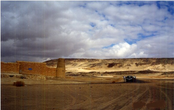
ヨルダン国境に近い半島北西部にある大きな火山地帯で、ラジル熔岩地帯(Harrat Al Rajil)とも呼ばれています。この火山帯は、独立した火山帯ではなく、シリア(Syria)からヨルダン(Jordan)およびイスラエル(Israel)を抜け、北部サウジアラビアまで広がる大規模なシャマ熔岩地帯(Harrat Ash Shamah)(هرات الشما)の南の3分の1です。この玄武岩性熔岩地帯は、総面積40,000 平方キロです。半島部分は、ヨルダン国境の町クライヤート(Qurayyat)の北からそこから南東にドゥーマ・ジャンダル(Dumat al-Jundal)向かって、涸れ谷シールハン(Wadi Sirhan)とほぼ平行に、幅75km長さ270kmで広がり、その面積は15,200平方キロにもなります。この熔岩地帯にはサウジアラビア野生生物保護委員会(NCWCD)が1987年に最初に設けた野生生物保護区があり、その面積は13,775平方キロもあります。トゥライフ(Turaif)からクライヤート(Qurayyat)への街道で、この熔岩地帯を横断すると、その広さを実感します。この熔岩地帯のクライヤート(Qurayyat)側の外れのカフ(Kaf)には、オスマン帝国(The Ottoman Empire)が1338年に築いた砦(Qasr)の遺構が残されています。
Harrat Al Harrah
It is a large volcanic area in the northwestern part of the peninsula near the Jordanian border, also known as the Razil Lava Zone (Harrat Al Rajil). This lava zone is not an independent lava zone, but a southern third of the massive Sharama Lava zone (هراات الشما) that extends from Syria through Jordan and Israel to the northern Saudi Arabia. This basaltic lava zone has a total area of 40,000 square kilometers. The Arabian Peninsula part extends to the south ward from the north of the Jordanian border town of Qurayyat, roughly parallel to the dry valley Wadi Sirhan, unto Dumat al-Jundal. It is 75 km wide and 270 km long, and its area is 15,200 square kilometers. The lava area is home to a wildlife sanctuary first established by the Saudi Arabian Wildlife Conservation Commission (NCWCD) in 1987 with an area of 13,775 square kilometer. Crossing this lava zone from Turaif to Qurayyat, we will realize how big it is. On the outskirts of the Qurayyat side of this lava zone, there is the remain of Qasr Kaf built by the Ottoman Empire in 1338.


ラハー熔岩地帯
Harrat ar Raha
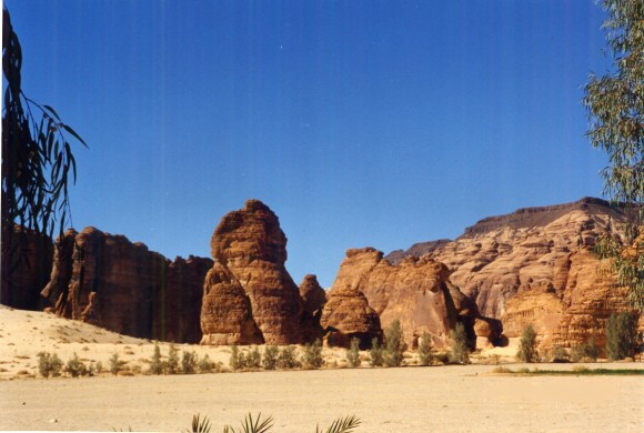
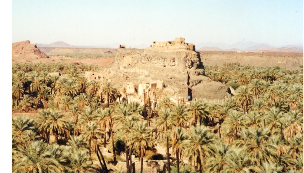
ラハー熔岩地帯(Harrat ar Raha)は、ヒスマー山地(Hisma or Hasma)の南に位置する熔岩地帯です。ヒスマー山地(Hisma or Hasma)は、サラワート山脈(the Sarawat Mountains)の北端部です。ラハー熔岩地帯(Harrat ar Raha)の南東にはハッラ・ウワイリド(Harrat ‘Uwayrid)およびハッラ・ザビン(Harrat az Zabin)が連なります。これら一連の熔岩地帯は、玄武岩質の熔岩がカンブリア紀(Cambrian)砂岩平原の上を軽く覆っています。黒く薄いい熔岩を被った赤い砂岩の崖(高さ100メートル以上)が露出しています。その崖の麓は、枝打ち椰子やナツメ椰子で縁どられています。黒と緑に縁取られた明るい赤い砂岩の崖が空の青さに調和しています。この調和が、ウラー渓谷(Wadi Al-Ula)の見事な景観を生み出しています。 ヒジャーズ鉄道(the Hijaz Railway)は、トブク(Tabuk)からマダーイン・サーリフ(Madain Salih)やウラー(Al-Ula)の南まで、この一連の熔岩地帯の北東側に沿うように敷設されていました。これは、紅海からの風を防ぐためだったのかも知れません。ハッラ・ラハー(Harrat ar Raha)の南領域にはディーサ(Disah、密林)の青々としたナツメ椰子の林や魅力的な渓谷涸れ谷カラキール(Wadi Qaraqir)の名勝があります。また、ディーサ(Disah)には城壁と住居跡と共にナバテア時代(Nabataeans or Al Anbat)およびイスラーム 初期の碑文が残されています。その他にハッラ・ラハー(Harrat ar Raha)の東端には紀元160年代に建てられたナバテア・ローマ寺院(Nabataean-Rome temple)の跡があり、碑文も残されています。
The Harrat ar Raha is a lava area located the south of the Massif Hisma. The Massif Hisma is the northern terminus of the Sarawat Mountains. To the southeast of Harrat ar Raha is a series of Harrat ‘Uwayrid and Harrat az Zabin. The series of lava zones is lightly covered by basaltic lava over the Cambrian sandstone plains. Red sandstone cliffs (more than 100 meters high) covered with black thin lava are exposed in the surrounding wadis. The base of the cliff is edged with dawn palms and date palms. Bright red sandstone cliffs edged with black and green harmonize with the blueness of the sky. This harmony creates a stunning landscape such as Wadi Al-‘Ula.
The Hijaz Railway was laid along the northeast side of this series of lava zones from Tabuk to the south of Madain Salih and Al-‘Ula. This may have been to prevent winds from the Red Sea. The southern region of Harrat ar Raha is home to the lush date palm dense forests of Disah and the scenic beauty of the charming valley of Wadi Qaraqir. Disah also has inscriptions of the Nabatea era (Al Ambat) and early Islamic periods, along with the remains of the city walls and dwellings. Also at the eastern end of Harrat ar Raha is the remains of the Nabataean-Rome temple, built in the 160s AD, with inscriptions.

ウワイリド熔岩地帯
この熔岩地帯は、ラハー熔岩地帯から南東に伸び、黒い帽子をかぶった壁のようにそびえ立ち、マダイン・サリフとウラーの両方の西側にそびえ立っています。いくつかの青銅器時代の墓が黒い熔岩台地に見ることができます。アラビアヒョウやアラビアガゼルを含む19種の絶滅危惧種と、43種の鳥が生息しています。さらに、55種の希少植物が生育しています。この熔岩地帯は、2022年6月15日にサウジアラビアでファラサン諸島に次いで「ユネスコの人間と生物圏プログラム」に参加する2番目のサイトと見なされました。
Harrat Uwayrid
It stretches southeast from the Harrat ar Raha and rises like a wall, worn a black cap, to the western side of the both Mada’in Salih and Al ‘Ula. Several Bronze Age tombs can be seen on the black lava plateau. It is home to 19 endangered species including Arabian leopards and Arabian gazelles and also 43 species of birds. In addition, 55 species of rare plants grow. This Harrat was considered on June 15,2022 the second site in Saudi Arabia to join “the UNESCO Man and the Biosphere Program” after Farasan Islands.
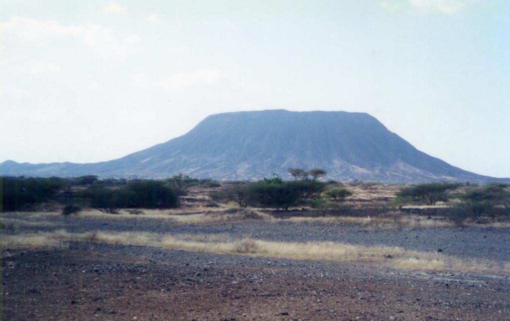
ハイバル熔岩地帯
ハイバル熔岩地帯は、アラビア半島中央部を代表する熔岩地帯の一つで、マディーナ(Madinah)を北から北西にかけて遠くから囲むこむように位置しています。また、ハイバル熔岩地帯は、ハッラ・グワイタート熔岩地帯(Harrat at Ghuwaytat)、フタイム熔岩地帯(Harrat Hutaym)、キシュブ熔岩地帯(Harrat Kishb)と共に涸れ谷ルマ(Wadi ar Rumah)(アラビア半島三大排水路の一つ)の上流域を形成しています。黒い玄武岩質の熔岩地帯で、100キロメートルの南北方向の線形噴出孔群(the north-south linear vent system)沿って形成され、7世紀頃まで噴火がありました。ほとんどが廃村になっている村落はナツメ椰子とモクマオウ(casuarina)で囲われていますが、涸れ谷には普通のナツメ椰子(date palm)とは違う種類のエダウチ椰子(dawn palm, hyphaene thebaica)が密生しています。エダウチ椰子の葉は扇子のような形をしています。付近の深い涸れ谷には必ずといえる程、エダウチ椰子が自生しています。ハイバル熔岩地帯(Harrat Khaybar)の黒ずんだ山や大地を北へと抜けると、突然、垂直な赤い崖に挟まれたウラー渓谷(Al ‘Ula Canyon)の回廊に出くわします。これは大変印象的でした。ハイバル熔岩地帯(Harrat Khaybar)は、古代に雄を振るったユダヤ教徒の古い砦が残っていることでも知られています。このユダヤ砦は、629年にムハンマドがマディーナ(Madinah)の北約150キロにあるユダヤ教徒のオアシス(ハイバル)へと遠征した時の古戦場だったと思われます。
Harrat Khaybar
Harrat Khaybar is one of the most representing lava areas of the central Arabian Peninsula. It surrounds Medina from north to northwest from a far away. Harrat Khaybar is also known as the upper reaches of the Wadi ar Rumah together with Harrat at Ghuwaytat, Harrat Hutaym and Harrat Kishub. (Wadi ar Rumah is one of the three major drainage channels of the Arabian Peninsula.) Harrat Khaybar is a black basaltic lava zone formed along the 100-kilometre north-south linear vent system. There were eruptions until about the 7th century. Most of the villages in this lava zone had been abandoned, however those villages have still been surrounded by date palms and casuarinas. But doum palms (hyphaene thebaica) are densely grown in the dry wadi valleys. A doum palm is a different kind of palm than an ordinary date palm. The leaves of a doum palm are shaped like a fan. In the deep dry valley nearby, doum palms grow naturally to an extent without fail. As we travel north through the blackened mountains and Harrat Khaybar, we suddenly come across the corridor of the Al ‘Ula canyon, flanked by vertical red cliffs. This was very impressive. The Harrat Khaybar is also known for the remains of an old Jewish fort that won the supremacy in ancient times in ancient times. This Jewish fort is thought to have been the old battlefield of Muhammad’s expedition to the Jewish oasis (Haibar), about 150 kilometers north of Madinah, in 629.


ルーナイル熔岩地帯
この熔岩地帯はシャーカ熔岩地帯(Harrah Al-Shaqah) (حرة الشاقة)とも呼ばれています。マディーナ(Madinah)とウムルジ(Umm Luji)の間に位置するアイス(Al-Ais)の西側に広がっています。1430年のマディナを中心とする地震では。北部に8km以上の浅い亀裂が形成されました。2009年には小さな地震の群れが発生した為に、2,300名近くの人々が避難しました。火山活動が活発化していると思われています。
Harrat Lunayyir
This lava area is also called the Harrah Al-Shaqah)(حرة الشاقة). It is spread out on the west side of the Ice (Al-Ais) located between Madinah and Umm Luji. During the earthquake epi-centered on Madina in 1430, more than 8 km shallow cracks formed in the northern part . In 2009, a small earthquake swarm caused nearly 2,300 people to evacuate. The volcanic activity is thought to be intensifying.
キシュブ熔岩地帯
この熔岩地帯は、ターイフ(Taif)北東240キロ付近を中心に広がり、金鉱のあるマハド・ザハブ(Mahd al Dhahab)と新旧メッカ街道の分岐ザリム(Zalim)の間にあります。余り触れられることは有りませんが、涸れ谷ハムド(Wadi Hamd drainage system)水系と涸れ谷涸れ谷ルマ・バーティン水系(Wadi ar Rumah/al Batin drainage system)の境となっています。すなわち、紅海とアラビア湾の分水嶺を成しています。
Harrat Kishb
This lava zone is centered around 240 km northeast of Taif, between Mahd al Dhahab and Zalim. Mahd al Dhahab is the oldest and biggerst gold-mine in this Peninsula. Zalim is the road fork between the old and new Mecca roads. Although it is not mentioned much, it is the boundary between the Wadi Hamd drainage system and the Wadi ar Rumah/al Batin drainage system. In other words, it forms a watershed between the Red Sea and the Arabian Gulf.
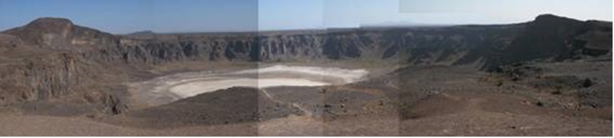
この熔岩地帯の南西の端にはアラビア半島の代表的な壮観な景観の一つとして知られるワフバ噴火口(Wahba Crater or Maqla Tamia)があります。この火口は直径3キロで、周囲11キロあります。200メートル以上落ち込んだ火口湖には水はありませんが、白いリン酸ナトリウムの結晶(White Sodium Phosphate Crystal)で覆われています。その白が周囲の玄武岩質の黒い熔岩流の固まった大地に映えて、際立っています。北側の火口壁の上の方に泡立ちながら湧き出す鉱泉があり、その下の棚状にナツメヤシ(Date Palm)の木立を作り、緑の草も厚く茂って、魅力的な景観を作っています。池の泥の中には蛙(Water Frog)や青い蛭(Green Leech)が生息しています。空に鳴き声が響かせているヒヨドリ(Bulbul)で、太陽鳥(Sunbird)は、この火口の近くのアカシア(Acacia)の林に小さな巣を作り、住んでいます。火口の周囲では火山活動で生成された光らない黒曜石(Obsidian)と半宝石の橄欖石(Peridot)が散在します。この火口から20Km北北東へ進むと3Km長さの湖があり、その周囲は不毛の地とはとても思えない様にアカシアの林と緑の潅木に被われています。
At the southwest end of this lava zone is the Wahba crater (Maqla Tamia), known as one of the most spectacular landscapes of the Arabian Peninsula. This crater is 3 km in diameter and has a circumference of 11 km. There is no water in the crater lake, which has fallen more than 200 meters, but it is covered with white sodium phosphate crystal. Its white stands out as it shines on the hardened earth surface of the surrounding basaltic black lava flows. There is a bubbling mineral spring above the crater wall on the north side. A terrace of date palm trees is formed under it, the green grass is thick there, and creates an attractive landscape. In the mud of the pond are inhabited by water frogs and green leeches. While a Bulbul chirps sound in the sky, sunbird builds and lives in a small nest in an acacia grove near this crater. No-shine obsidians and semi-gemstone peridots were produced by a volcanic activity and they scatter around the crater. Twenty kilometres north-northeast of this crater is a 3 kilometre-long lake surrounded by acacia groves and green shrubs that hardly seem barren.
6,000平方キロ弱の熔岩地帯には、噴石丘(scoria cone)や溶岩流(lava flow)の他に、カーフ・ムテーブ(Kahf Al Mut’eb)、カーフ・アシュバア(Kahf Al Ashbaah)、ダハル・ファイサル(Dahl Faisal)等の六つ熔岩洞窟も見られます。
This lava zone spreads over not more than 6,000 square kilometres and include scoria cones, lava flows, as well as six lava tubes. Three main lava tubes are Kahf Al Mut’eb, Kahf Al Ashbaah and Dahl Faisal.
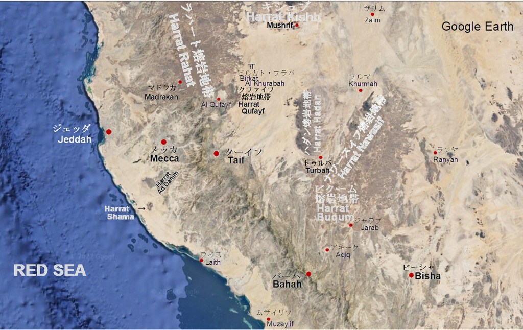
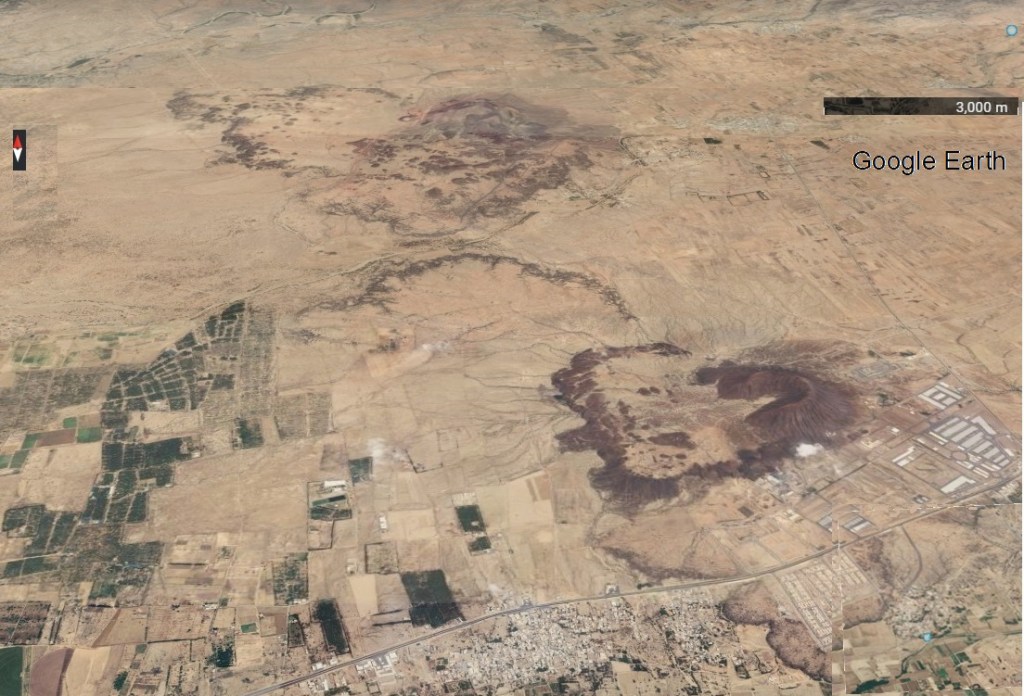
キシュブ熔岩地帯(Harrat Kishb)とラハート熔岩地帯(Harrat Rahat)との間には、バラカト・ハラーバ遺跡(Birkat Al Khurabah)(بركة الخرابة)およびマハド・ザハブ(Mahd al Dhahab)を通って、メッカとバクダット間を結ぶダルブ・ズバイダ巡礼路(Darb Zubaidah)が通っていました。私がダルブ・ズバイダ巡礼路(Darb Zubaidah)を辿ろうとしていた時には、ほとんど道は無く、舗装道路はさらに限られていて、難儀しました。しかし、google earthで調べると、現在ではメッカ道路のカンファリヤ(Qanfariyah)からムシュリフ(Mushrif)やウンム・ダウム(Umm ad Dawm)を経由してワフバ火口入口のネムラン部落(Nemran)までだった道路が、マハド・ザハブ(Mahd al Dhahab)まで舗装道路が延長されています。また、メッカ・マディーナ街道から東に向かう舗装道路の終点だったマハド・ザハブ(Mahd al Dhahab)から旧メッカ街道のアフィーフ(Afif)まで舗装道路が整備されています。陸の孤島の様だったこの地域も飛躍的にアプローチし易く成った様です。因みにワフバ噴火口(Wahba Crater)へは、ネムラン部落(Nemran)から北に入ったジザ‘アン(Al Jidh’an)集落から出入りします。
Darb Zubaidah pilgrimage route had passed between the Harrat Kishb and the Harrat Rahat. Darb Zubaidah pilgrimage route connectes between Mecca and Baghdad through Birkat Al Khurabah (بركة الخرابة) and Mahd al Dhahab.
When I was trying to trace the Darb Zubaidah, there were few roads in this area and any paved roads were even more difficult to find. It made me hard to do so. Still, there was a paved road from Qanfariyah on the Mecca Road to the Nemran hamlet at the entrance to the Wahba crater, via Mushrif and Umm ad Dawm. According to the reacent google earth, this paved road has already been extended to Mahd al Dhahab.
Also, the another road extension has been done from Mahd al Dhahab to Afif, which is one of the main towns along the old Mecca road. Mahd al Dhahab was then the terminus of a paved road heading east branching from the Mecca-Medina highway.
This area was then an isolated island on the earth surface. The above 2 road extensions made us dramatically easier to access this area. By the way, to Wahba Crater, I got north from Nemran hamlet and entered to there from the settlement of Al Jidh’an.
ラハート熔岩地帯
アラビア半島最大の熔岩地帯で、広さは20,000 平方キロあります。マディーナ(Madinah)から南へメッカ(Mecca)・ターイフ(Taif)向けて、平均幅60キロで 300キロに渡って延びています。熔岩流は、熔岩地帯の軸から西に100キロも延びている場所もあります。 この熔岩地帯には玄武岩質の噴石丘(scoria cone)が500を超え、多くは複合的な構造を形成する複数の噴出口を備えています。火砕流とサージ堆積物を伴う小さな楯状火山、爆裂火口や熔岩ドームも存在します。 最近の活動としてよく知られている噴火は、西暦1256年に発生し、6つの整列した噴石丘(scoria cone)から流れ出した熔岩流は、マディーナ(Madinah)へ23キロの場所まで移動しています。この熔岩地帯の北部は、マディーナ熔岩地帯(Harrat Al Madinah)と呼ばれることもあります。
Harrat Rahat
It is the largest lava region in the Arabian Peninsula and covers an area of 20,000 square kilometers. From Madinah to Mecca and Taif, it extends 300 km with an average width of 60 km. In some places, the lava flow extends as far as 100 kilometers west of the axis of the lava zone. This lava zone has more than 500 basaltic scoria cones, many with multiple fumaroles forming complex structures. There are small shield volcanoes, explosive craters and lava domes, etc. A small shield volcano is accompanied by pyroclastic flows and surge deposits. Among the past eruptions, one better known as the most recent activity occurred in 1256 AD. The lava sprang out of the six aligned scoria cones. The lava flew up to the location which is 23 km away from Madinah. The northern part of this lava zone is sometimes referred to as the Medina Lava Zone (Harrat Al Madinah).
シュワイルキーヤ(As Suwayrqiyah)(السويرقية)は、この熔岩地帯の東側に隣接し、マハド・ザハブ(Mahd al Dhahab)道路の北側にある広大な (Sabkha)です。このサブハの中には7 – 8メートル位の畝を大きくした様に高く成った部分が幾筋も平行に並び、中には何故かサブハ(Sabkha)の中に平頂山(Table Mountain)状に孤立したものも見られ、他では見られない特異な景観に思われました。しかし、改めてGoogle Earthで見ると平行した筋は無く、熔岩丘がサブハの中に孤立して点在するばかりです。熔岩丘の上部が平らで高さもあまり違わないので、遠目には畝の様に見えたのだと思います。
As Suwayrqiyah (السويرقية) is adjacent to the eastern side of this lava zone. It is the vast sabkha on the north side of the road going to Mahd al Dhahab. In this subkha, there are many parallel lines of low ridges about 7 to 8 meters high, and some of them are isolated in the form of a Table Mountain in the sabkha for some reason. It seemed to be a rarely unique landscape that could not be seen anywhere else. However, reviewing it with Google Earth again, there is not any parallel streak, and only lava hills merely scattered and isolated in the sabkha. Those lava hills were flat and those heights were not very much different, therefore they might be looked as low ridges from a distance.


ラハート熔岩地帯(Harrat Rahat)へのアプローチは、不便でした。以前は、メッカ(Mecca)・マディーナ(Madinah)高速道路に加えて、この高速道路のアクサル(Al Aksal)からほぼ、真東に向かい、マハド・ザハブ(Mahd al Dhahab)までの道路があるだけでした。現在では、マディーナ(Madinah)からマハド・ザハブ(Mahd al Dhahab)およびマドラカ (Madrakah)(مدركة)からビルカト・フラバ (Birkat Al Khurabah)(بركة الخرابه)を結ぶ道路が新設されています。
The approach to the Harrat Rahat was inconvenient. Previously, in addition to the Mecca-Madinah highway, there was only a road from Al Aksal on this highway almost straight east to Mahd al Dhahab. New roads were built both from Madinah to Mahd al Dhahab and from Madrakah (مدركة) to Birkat Al Khurabah (بركة الخرابه), since then.
ビクーム熔岩地帯
ビクーム熔岩地帯は、バーハ(Al Bahah)の東北東にあり、メッカ州(the Makkah Province)とバーハ州(the Al Bahah Province)の州境の北東部に広がる熔岩地帯(Lava Area)です。この熔岩地帯北部の殆どがナワースィフ熔岩地帯(Harrat Nawasif)と接している為に、ナワーシフ・ビクーム熔岩地帯(Harrat Nawasif- Buqum)として扱われることも少なくありません。両熔岩地帯を合わせた総面積は11,000平方キロです。サラワート山脈(Sarawat Mountains)の北東斜面を源流とする涸れ谷スバイウ(Wadi Subay)と涸れ谷ランヤ(Wadi Ranyah)の間に挟まれています。周囲にはハッシュラージ(Al Hashraj)(لحشرج)、トゥルバ(Turbah)、フルマ(Al Khurmah)、ランヤ(Ranyah)およびジャラブ(Jarab)(جرب)等の村落があります。
この熔岩地帯には、トゥルバ(Turbah)の東で、両熔岩地帯の境界に付近にヒバシ熔岩洞窟(Ghar al Hibashi) 熔岩洞窟があります。地表から約6〜7 mの深さに、直線状の581mメートル通路が延びています。主な入口は東西に2つあります。内部には熔岩鍾乳石(lava stalactites)、石筍(stalagmites)、柱(columns)が形成されています。洞窟の温度が20〜21°Cで、湿度48パーセントに保たれているので、人間を含む、ハイエナ、オオカミ、キツネ、コウモリ、鳥、家畜の乾燥した骨が残されています。今後、考古学的に有効利用されると思われます。
Harrat al Buqum
The Harrat al Buqum is located east-northeast of Al Bahah and spreads in the border area between the Makkah province and Baha province. Since most of the northern Harrat al Buqum is bordered by the Harrat Nawasif, they are often treated as a lava area called as the Harrat Nawasif – Buqum. The combined total area of both lava areas is 11,000 square kilometers. The Wadi Subay flows their northern boundary, while the Wadi Ranyah flows their southern boundary. The both wadis are originating on the northeastern slopes of the Sarawat Mountains. There are Al Hashraj (لحشرج), Turbah, Al Khurmah, Ranyah and Jalab (جرب) and other villages in their surroundings.
There is one lava cave in the boundary of the both lava areas locating east of Turbah. This is a lave cave called the Ghar al Hibashi. A straight 581 m meter passage extends at a depth of 6 to 7 m from the surface. There are two main entrances, one on the east and the other on the west. Lava stalactites, stalagmites and pillars. (columns) are formed in this lava cave. The temperature of the cave is kept at 20-21 ° C with the humidity of 48 percent, so that it is possible to retain dried bones such as hyenas, wolves, foxes, bats, birds and domestic animals, even including humans. They are expected to be used effectively in the archaeological research.
ビルク熔岩地帯
ビルク熔岩地帯(Harrah Birk)は火砕性火山錐(Pyroclastic Cones)が点々と並ぶ、ぞっとするような不吉な黒色をした玄武岩平原で、黒い沙漠とも呼ばれる。広がりはジーザーン(Jizan)北西のシュカイク(Shuqayq)からクンフザ(Qunfudhah)に及び、その面積は約1,200平方キロに及びます。ビルク熔岩地帯の一番古い部分の殆どは噴出岩(Effusive Rock)で構成され、海岸平原に位置しています。円錐形をした顕著な火口丘(scoria cone)である火山錐(Conspicuous Cones)は高さが400mに達するものもあり、数百個が火山地帯全体に散らばっています。アラビアのハッラ (Harrat)は2百万年から3千万年前に形成されてはいるが、現在でも火山活動は続いており、ビルク熔岩地帯での最後の噴火は1820年に起きたと考えられています。
ビルク熔岩地帯(Harrat al Birk)で最も共通した物質は、黒色或いは赤色をした、ゆるく、塊になっている角ばった多孔質の岩滓(scoria)です。その中には気泡を持つ火山弾(volcanic bomb)も混じっています。火山岩滓は軽石に似た火山性の材料で市場では住宅の天然断熱材として売られているのが見られます。
ハッラ(Harrah)の植物には生長を阻害されてはいるが美しく花を咲かせアカシヤ(Acacia)、熔岩地帯で顕著に見られる大きな扇型の葉を付けるエダウチ椰子(doom palm, hyphaene thebaica)や多肉質で光っている槍の様な葉を持つソドムの林檎とも呼ばれる死海林檎(calotropis procera)の木等があります。
ビルク熔岩地帯の紅海岸は熔岩が広がるマングローブの湿地帯となっています。マングローブがあると云う事は汽水域の存在を示しており、近代まで真珠取りを行われて居たし、魚の宝庫であり、ここには多くの渡り鳥が飛来します。残念なのはこの環境がエビの養殖に適している為に養殖場に転換かれています。
マンジャハ遊牧民(Manjahah nomad)の一部はビルク(Birk)とシュカイク(Shuqayq)の間にあるこの火山性の沙漠に今でも住んでいます。
Harraht al Birk
The Harrat al Birk is a gruesome, ominous black basalt plain dotted with pyroclastic cones, and is also known as the Black Desert. The area stretches from Shuqayq at 110km north northwest of Jizan to northward untill Qunfudhah and covers an area of about 1,200 square kilometers. Most of the oldest part of this lava zone consists of the effusive rocks and is located on the coastal plains. Conspicuous cones, a prominent cone-shaped crater cone (scoria cone), can reach heights of up to 400 m, with hundreds scattered throughout the volcanic area. Although the Arabian Harrat was formed between 20 – 30 million years ago, volcanic activity is still ongoing, and the last eruption in the Harrat al Birk is thought to have occurred in 1820.
The most common material in the Harrat al Birk is the loose, lumpy, angular porous scorches (scoria) of black or red color. Among them are volcanic projectiles (volcanic bomb) with bubbles. Volcanic tailings are volcanic materials similar to pumice stones and are seen in the market as natural insulation materials for house building.
The Harrat plant has a beautifully flowering acacia (Acacia) although it is inhibited from growing, and the doom palm (hyphaene thebaica) with large fan-shaped leaves that are prominent in any lava area. and the Dead Sea apple (calotropis procera). This is also known as the Sodom apple with fleshy, glowing spear-like leaves.
The Red Sea coast of the Birk Lava Zone is a mangrove wetland with spreading lava rocks. The presence of mangroves indicates the existence of fresh water as brackish water, which were good for pearl fishin until modern times and are a treasure trove of fish, where many migratory birds fly around. Unfortunately, this environment has been converted into fish farms because it is suitable for shrimp farming.
Some of the Manjahah nomad still live in this volcanic desert between Birk and Shuqayq.

シラート熔岩地帯
シラート熔岩地帯(Harrat as Sirat)は、ハルジャ(Al Harjah)とサラート・アビーダ(Sarat Abidah)間の山稜を覆う熔岩台地です。ザハラーン・ジャヌーブ(Dhahran Al Janoub)からハルジャ(Al Harjah)の山稜を40 キロ北上すると、標高 2,160 メートルのハルジャ(Al Harjah)を通り抜けます。その北5~10キロ付近では道路造りの為に山肌が削れていました。そこでは白、青白、赤等層が現れ、地表は噴石や黒い熔岩に覆われています。その中の白と赤褐色の層は、輝石の含有の多い閃緑岩と思われます。黒い熔岩は、ハルジャ(Al Harjah)の南からサラート・アビーダ(Sarat Abidah)の西まで33 キロにわたって、サラワート山脈(Sarawat Mountains)の山稜を覆っています。
Harrat as Sirat
Harrat as Sirat is a lava plateau that covers the mountain ridge between Al Harjah and Sarat Abidah in the Asir Mountains. Al Harjah locates at 40 kilometers from Dhahran Al Janoub, and at 2,160 meter high. When I passed by, the mountain face was being scraped for road construction at around 5 ~ 10 km north from Al Harjah. White, blue-white, and red layers appear there, and the surface of the earth is covered with lava. The white and reddish-brown layers appear to be diorite with a high pyroxene content. The black lava covers the ridges of the Asir Mountains for 33 kilometers from south of Al Harjah to west of Sarat Abidah.

ティハーマ・アシール熔岩地帯
ティハーマ・アシール熔岩地帯(Harrat Tihama Asir)は、さらに小さな二つの熔岩地帯から構成されています。北地帯は、ジーザーン(Jizan)北30キロにある町サブヤー(Sabya)の北東10キロから15キロの範囲に二つの噴石丘(scoria cone)を持って並んでいます。南地帯は, ジーザーン(Jizan)の東25 kmのアブー・アリーシュ(Abu Arish)の町の東8キロ位にある小さな熔岩地帯(Harrat)です。道路を挟んで南北にそれぞれ火口を持った小さな火山があり、対峙しています。その直ぐ東側にマラーキー・ダム(Malaki Dam)と云う貯水池があり、大きな水量のダムの様でした。その奥にある大きなゴミ消却場の上を鳶が何羽も群れて旋回しているのが印象的でした。
Harrat Tihama Asir
The Harrat Tihama Asir consists of two smaller lava areas. The northern zone is lined with two scoria cones and locates from 10 km to 15 km northeast of the town Sabya, which is 30 km north of Jizan. The southern zone is a small Harrat area about 8 km east of the town of Abu Arish, which locates 25 km east of Jizan. There is a small volcano with craters respectively on the north and south sides of the road, facing each other. Its eastern side is a reservoir called the Malaki Dam, which looked like a dam with a large amount of water. It was impressive to see a number of pigeons circling in flocks on top of the large garbage disposal site at the back.

イエメン熔岩地帯
イエメンはアラビア半島の南西の角を形成し、大地溝帯がヌビアプレート、ソマリアプレート、アラビアプレート(the Nubian, Somali, and Arabian plates)の境に沿ってアデン湾と紅海へ別れるアファール分岐(The Afar Triple Junction (also called the Afro-Arabian Rift System)に隣接し、その海岸線はそれぞれ、分岐したそれぞれの地溝帯に沿って形成されています。従って、火山活動が盛んな最も活発な構造プレート境界の1つです。イエメンの火山地帯は、主なものだけでも11ヵ所あり、イエメン西部に限らず、イエメンの中部や東部にも存在します。アラビア半島の熔岩地帯としては、サウジアラビアに散在する熔岩地帯に合わせて、新生代の火山地帯(Cenozoic volcanic fields)に限定しました。このホームページではアターグ熔岩地帯(Harrat Atag)に加えて、イエメン中央山地およびイエメン西部山地を一括してイエメン熔岩地帯(Harrat Yemen)として紹介するに留めました。
Harrat Yemen
Yemen forms the southwestern corner of the Arabian Peninsula, with The Afar Triple Junction (also called the Afro-Arabian Rift) dividing along the border of the Nubian, Somali, and Arabian plates into the Gulf of Aden and the Red Sea. System), and its coastline is formed along each of its divergent rift valleys. It is therefore one of the most active tectonic plate boundaries with high volcanic activity. There are 11 volcanic areas in Yemen alone, not only in western Yemen, but also in central and eastern Yemen. As for the lava areas of the Arabian Peninsula, we limited them to the Cenozoic volcanic fields in accordance with the lava areas scattered in Saudi Arabia. In addition to the Harrat Atag Zone, this home page has introduced the Yemen Central Mountains and the Yemen Western Mountains collectively as the Harrat Yemen.
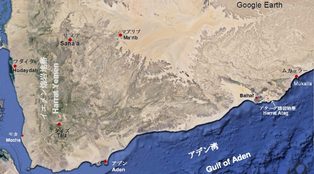
アターグ熔岩地帯
アターグ熔岩地帯(Harrat Atag)は、アデン湾沿いの小さな熔岩地帯です。この熔岩地帯は、バルハーフ・ビール・アリー火山地帯(Balhaf-Bir Ali Volcanic Field)とバルハーフ熔岩地帯(Harra of Bal Haf)から成っています。バルハーフ・ビール・アリー火山地帯(Balhaf-Bir Ali Volcanic Field)は、ハドラマウト県庁所在地(the capital city of the Hadhramaut Governorate)で貿易港でもあるムカッラー(Mukalla)南西120キロの海岸沿い位置します。タバーブ凝灰岩円錐丘(At-Tabâb tuff cone)が海から約200 mの高さにあり、幅1.5 kmの火口(crater)が、噴石丘(scoria cone)とそれに伴う溶岩流(lava flow)で部分的に満たされています。東に隣接する凝灰岩の円錐丘(tuff cone)には湖があります。バルハーフ熔岩地帯(Harra of Bal Haf)は、ムカッラー(Mukalla)南西100キロの海岸に位置します。標高233メートルのチャンピオン火山(Champ Volcanique)と玄武岩の古い熔岩流(one historical aged basaltic lava flow)で構成されています。
Harrat Atag
The Harrat Atag is a small lava area along the Gulf of Aden. This lava area consists of the Balhaf-Bir Ali Volcanic Field and the Harra of Bal Haf. The Balhaf-Bir Ali Volcanic Field is located along the coast 120 km southwest of Mukalla, the capital city of the Hadhramaut Governorate and a trading port. The At-Tabâb tuff cone has the height of 200 m above the sea, and the 1.5 km wide crater is partially filled with a scoria cone and an accompanying lava flow. There is another tuff cone containing a lake adjacent to its east. The Harra of Bal Haf is located on the coast 100 km southwest of Mukalla. It consists of the Champ Volcanique at an altitude of 233 m and an old basalt lava flow.

