
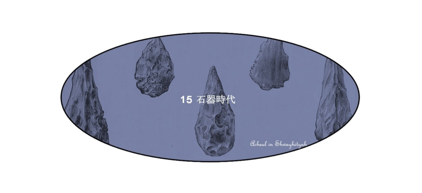
15 Stone Age


目次 (Index)
はじめに
Introduction
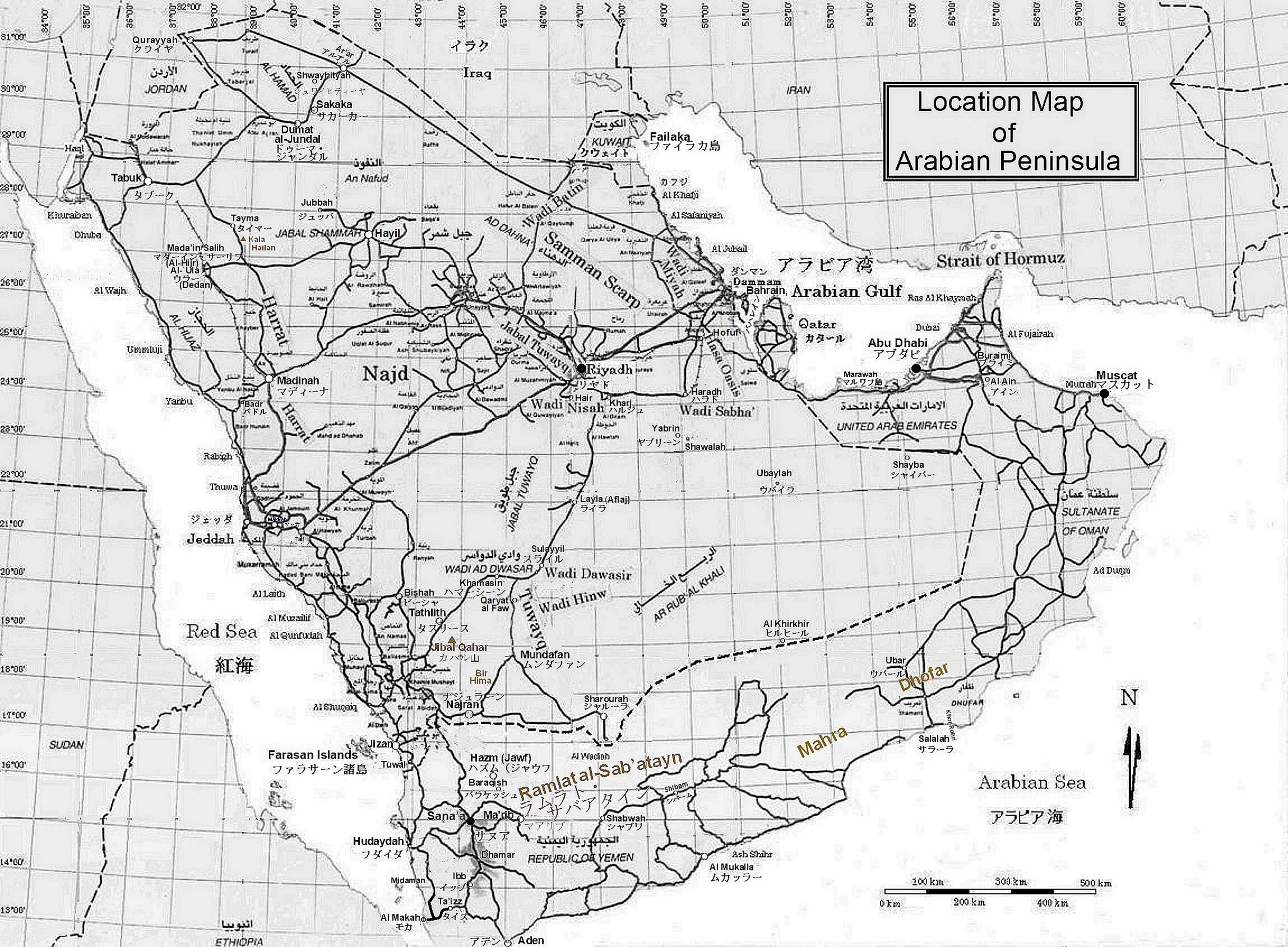
アラビア半島は、数百万年前に出現した人類がアフリカからユーラシアへと移動し、世界中に広がった通り道であり、石器時代の文化は150万年前に始まり、紀元前2000年近くまで続いていました。半島で最も古い旧石器時代の遺跡は、ジャウフ州北東部にあるシュワイヒティーヤで、120万年前に遡ります。半島にある100万年以上前の飛び抜けて古い旧石器時代の遺跡は、その他にナジュラーン遺跡と涸れ谷タスリース東岸カハル山南遺跡があります。ナジュラーン遺跡はシュワイヒティーヤ同様に後期オルドワン文化に属し、カハル山南遺跡は同時代ではありますが、次世代のアシュール文化(15万年前までの長期にわたって続いた手斧文化)に属します。これらの遺跡が発見された地層の年代は258万年前に始まった更新世であり、ヨーロッパや北アメリカの北部が巨大な氷河に被われたので氷期とも呼ばれています。この時代でもアラビア半島が氷河に被われる事は無く、氷期には涼しく乾燥し、間氷期には気候は温暖で湿気があり、涸れ谷構造の発達した場所では川が流れて住み易い環境を作り出し人間の営みが活気付いたに違いありません。
The Arabian Peninsula is a passage through which humans that emerged millions of years ago migrated from Africa to Eurasia and spread throughout the world, and Stone Age culture began 1.5 million years ago and lasted until nearly 2000 BC. The oldest Paleolithic site on the peninsula is the Shwayhityah site in northeastern Jawf Province, dating back 1.2 million years. Other by far the oldest Paleolithic sites on the peninsula dating back more than 1 million years are the Najran site and the southern Jibal Qahar site on the east coast of Wadi Tathlith. The Najran site, like the Shwayhityah site, belongs to the Developed Oldowan culture, and the southern Jibal Qahar site, although contemporary, is a member of the next generation of the Acheulean culture (The Acheulean culture, characteristic of hand axes use, lasted for a long time up to 150,000 years ago). The strata in which these sites were discovered date back to the Pleistocene, which began 2.58 million years ago, and are also called the ice ages because the northern part of Europe and North America was covered by huge glaciers. Even during this period, the Arabian Peninsula was not covered by glaciers, it was cool and dry during the Ice Age, the climate was temperate and humid during the inter-ice age, and in places with developed wadi structures, rivers flowed to create a livable environment and human activities must have been energized.
旧石器時代
Paleolithic Age
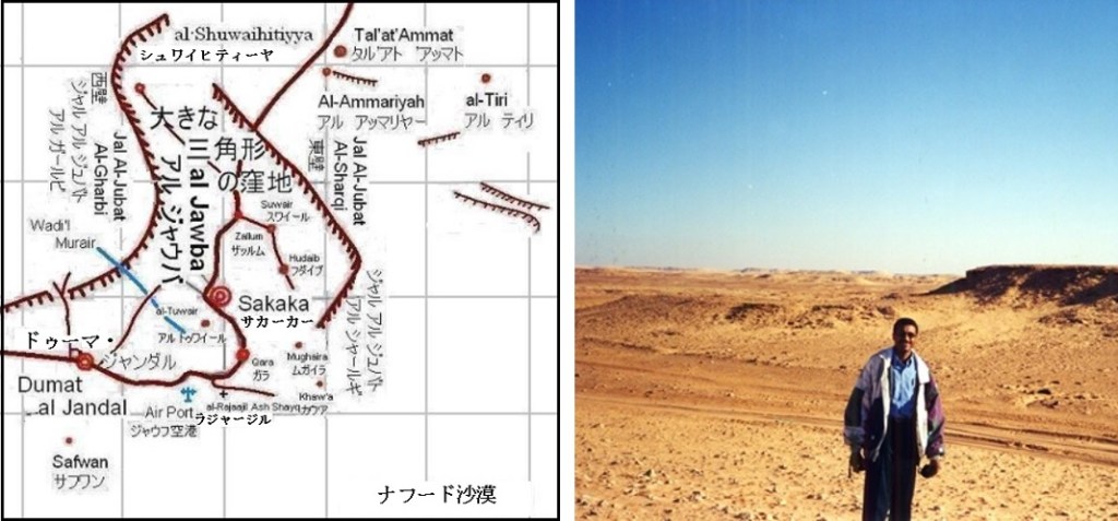
シュワイヒティーヤは周囲から60~150m陥没した大きな三角形(底辺75kmで高さが60km)をしたジャウバ窪地の頂点に当たる一番北に部分に位置しています。噴出、噴火口や熔岩流等の火山活動の跡が残って居り、石器は珪石から割り出された石片です。その後もアシュール文化期から新石器後期までの長い間、人類がこの地域に居住していました。筆者は2001年12月に訪れましたが、タールマックの道が途切れた場所にあった給油所の先は、小さな珊瑚礁の石灰岩の岩山が幾重にも並び、崖地から吹き下ろす風の音だけの聞こえる沙漠でした。ベドウインが給水車でさらに奥へと水を運搬しているので、今でも人の営みが何処かにあるのでしょう。ジャウバ窪地の南端等ではムスティエ期に属する中期旧石器時代遺跡が豊富に発見されています。その後は氷期の終わりに起きた乾燥状態の為か、新石器は発見されていません。
The Shwayhityah site is located in the northernmost part of the Jawba depression, which is a large triangular shape (75 km at the bottom and 60 km high) that has been sunk 60 to 150 m from the perimeter. Traces of volcanic activity such as eruptions, craters and lava flows remain, and the stone tools are stone fragments made from quartzite. For a long time thereafter, humans inhabited the area from the Acheulean period to the late Neolithic period. I visited in December 2001 at Shwayhityah, and the gas station was located at the end of the road where Tarmac was cut off. There were many layers of small coral reef limestone rocks, and the sound of the wind blowing down from the cliff was heard. The Bedouin carries water further back in the water truck, so there must still be human activity somewhere. At the southern end of the Jawba Depression, the Middle Paleolithic sites belonging to the Mousterian culture have been found in abundance. Since then, perhaps due to the arid conditions that occurred at the end of the Ice Age, no Neolithic tools have been discovered.
新石器時代
Neolithic Age
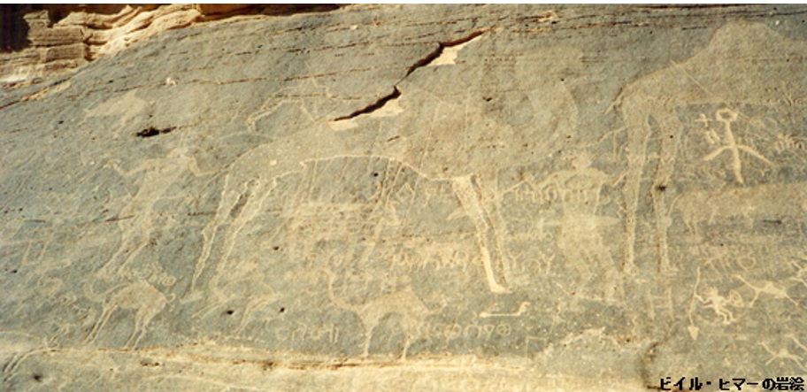
最後の氷期の終りに気候の変動によって1.7万年前頃にルブア・ハーリー沙漠周縁部のヤブリーン、ライラ、ムンダファン、ラムラト・ サバアタイン等にあった湖沼は干上がるか、極端に小さく成ってしまいました。森の散在するサバンナ草原は薄くなり死滅し、今日見られるルブア・ハーリーの荒れ果てた沙漠状態に成りました。安定した表土が一旦無くなると、その下の砂層が風で飛ばされて広大な砂沙漠を作りだして砂丘状態となります。新石器時代には石面に宗教的目的の為に人物が生き生きと描かれ、又、水が豊富な場所に居る牛、馬、レイヨウ、ガゼル、犬、駝鳥、ライオン等の動物も描かれました。その動物相は時代が経つに連れて水が乏しくても生存できる駱駝や羊に変わりました。これはアラビア半島が3万3千年前から1万8千年前までの雨の多い時代から1万5千年前までに沙漠化した事を示しています。
There had been lakes and marshes on Yablin, Layla, Mundafan, and Ramlat al-Sab’atayn in the Rub’ al Khali Desert periphery. They either dried up or became extremely small at the end of the last ice age, due to climate changes, around 17,000 years ago. The savannah meadows with scattered forests also faded to the ground and deserted state like the Rub’ al Khali as we see it today. Once the stable topsoil is gone, the sand layer below it is blown away by the wind, creating a vast sandy desert and creating a sand dune state. In the Neolithic period, figures were vividly depicted on the stone surfaces for religious purposes, as animals were depicted. Such animals were cows, horses, antelope, gazelles, dogs, ostriches, and lions at water-rich areas. Over time, those animals were changed to camels and sheep. It was because camels and sheet can survive with scarce water. This indicates that the Arabian Peninsula was desertified by 15,000 years ago, from a rainy period (from 33,000 to 18,000 years ago).
9,000年前の雨の再来は再び人間がこの土地に移住するのに適した環境の再来をもたらしました。この時代の気候の変化により特にアラビア半島の南半分に湿った気候が戻って来ました。今日では本当に南海岸にしか雨をもたらさないモンスーンが北に偏向して居り、ルブア・ハーリー沙漠全体に季節的な雨をもたらしていました。厚い草地が再び生まれ砂丘地帯の砂は表土に被われました。湖底には水が戻り緑の大地と豊かな野生動物に人間が引きつけられ、その時代の住居跡が全ての場所で見つかっています。この時代の人間の活動は新石器文明と云い、全く新しい道具を使う文明に特徴づけられます。9,000~6,000年前の間の後期湿潤時代に人間は今では消えてしまった湖沼や流れの畔に数十万点もの美しい石器を残していました。特にアラビア半島東部では断続的であったにせよ8,000~4,000年前の間には今日よりも快適な気候が続いた事を暗示しています。ルブア・ハーリー沙漠外周域のナジュラーン、ハマーシーン、スライル、アフラージュ(ライラ)およびヤブリーンにも、動物の家畜化と作物の栽培を最初に行った新石器文明の広い集落がありました。又、北東部の海岸およびファイラカ島とバハレインの島で石器時代の漁師や貝採食者の集落が紀元前三千年紀 に遡って発見されています。時代は特定出来ないにせよ、半島の多くの場所でのサハラ沙漠同様の岩絵の存在とフリント(燧石)製道具の散乱がその類似性を考えさせています。
The resurgence of rain 9,000 years ago has once again brought about a resurgence of conditions suitable for humans to settle into the land. Changes in climate during this period brought a return to a humid climate, especially in the southern half of the Arabian Peninsula. Today, the monsoon, which really only brings rain to the south coast, was biased to the north, bringing seasonal rain throughout the Rub’ al Khali desert. Thick grasslands were re-created and the sand of the dune areas was covered with topsoil. The bottom of the lake has been flooded with water to bring back greenery and abundant wildlife. And the remains of their former dwellings have been found everywhere. The human activity of this period is called Neolithic civilization, characterized by a civilization that uses entirely new tools. During the late wet period between 9,000 and 6,000 years ago, humans left hundreds of thousands of beautiful stone tools on the banks of lakes and streams that have now disappeared. Especially in the eastern part of the Arabian Peninsula, even if it was intermittent, between 8,000 and 4,000years ago, it implies that the climate was more pleasant than it is today. The Neolithic civilizations of Najran, Khamasin, Sulayyil, Aflaj (Layla) and Yabrin in the outer Rub’ al Khali Desert were also the first to domesticate animals and grow crops. There was a large settlement of: Settlements of Stone Age fishermen and shellfish foragers have also been found on the northeastern coast and on the islands of Failaka and Bahrain, dating back to the third millennium BC. Although the period cannot be determined, the existence of rock paintings similar to those of the Sahara Desert in many places on the peninsula and the scattering of flint tools make us think of the similarities.
新たな発見
New Discoveries
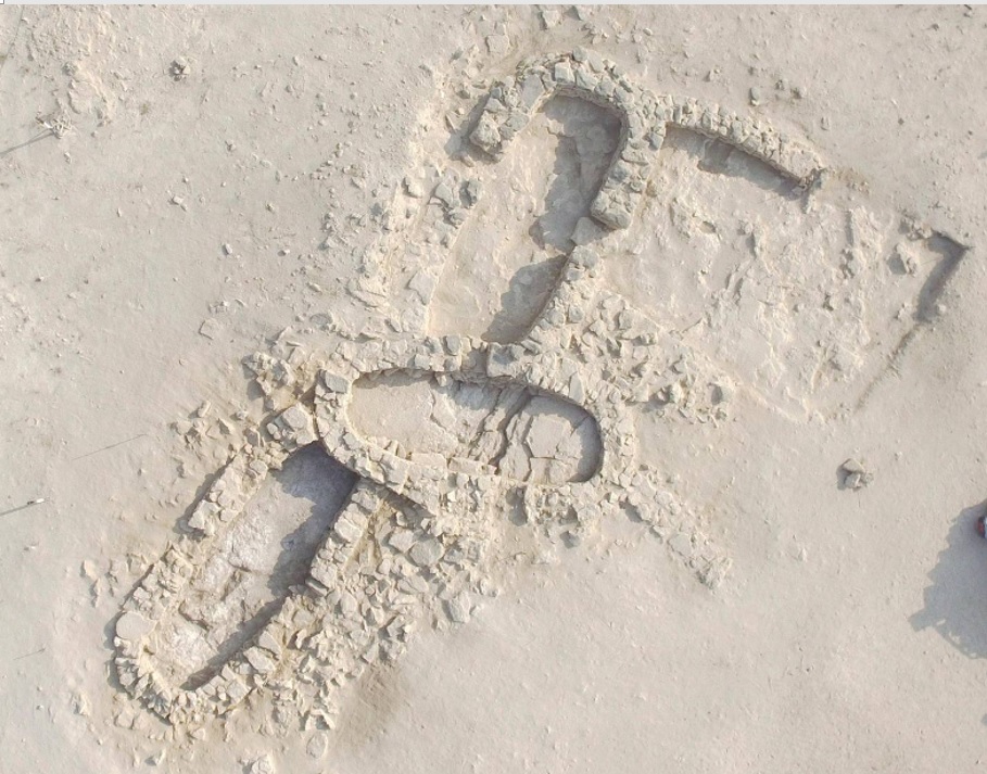
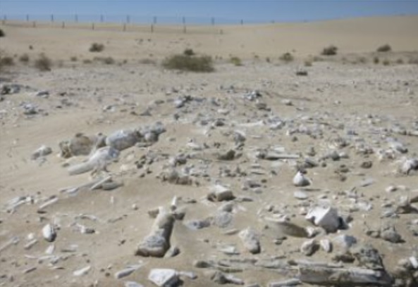
この時代の新たな発見にはサウジアラビア遺跡観光庁が2011年8月に発表したマガール遺跡があります。マガール遺跡はアラビア半島中央部のハマーシーン(涸れ谷ダワースィル地方の中心地)の西南西50km付近の農場内に位置します。筆者が2003年2月に通過した時、離れマントヒヒがその道路脇の岩山に居ました。不思議に思いながら水とホブツを与えましたが、その南に農場があったのであれば、そこに居たことはある程度は理解できます。遺跡はナジュド高地と東の山塊が分かれる場所にあり、その周囲には小さな丘と多くの谷が広がっています。滝のある大きな谷が西に流れて灌漑水を提供し、既に農業と家畜の飼育を行っていました。この遺跡は9,000年前のものですが、アラビア半島の伝統である「馬の繁殖・乗馬、鷹狩り、猟犬による狩猟およびダガー(石の短剣)の使用」が既に行なわれていました。特筆は「馬の飼育は中央アジア5,500年前から始まった」との説を覆し、その3,500年も前からマガールでは馬の飼育が行なわれていた事です。そのため、「マガール文明」と名付けた学者も少なくありません。
New discoveries from this era include the Magar site, announced in August 2011 by the Saudi Arabian Archaeological and Tourism Authority. The Magar site is located on a farm about 50km west-southwest of Khamasin (the center of the Wadi al Dawasir region) in the central Arabian Peninsula. When I passed by in February 2003, one Hamadryas baboon, detached from a herd, was on a rocky mountain beside the road. I gave the water and Arabian Bread (Pita Bread) (خبز) to this baboon while wondering why he was there. But if there was a farm to the south of there, it would be understandable. The ruins are located at the juncture of the Najd Highlands and the eastern massif, surrounded by small hills and many valleys. A large valley with a waterfall flowed west to provide irrigation water, and it was already engaged in agriculture and livestock rearing. Although the site is 9,000 years old, the Arabic Peninsula tradition of “horse breeding, riding, falconry, hunting by hounds and the use of daggers (stone daggers)” was already practiced. The most notable mention is that horse breeding were said to begin 5,500 years ago in the Central Asia, but horse breeding had been practiced in Magar 3,500 years before that, and not a few scholars have named it “Magar civilization”.

2017年初めにもアブダビの沖合15kmのマルワフ島で7,000年前の居住遺跡や南東130kmのバイヌナ遺跡で6,500年前の大量狩猟された駱駝の発見が報告されています。太古に陸地であったアラビア湾の海底ではさらに多くの石器時代の遺跡が発見・発掘されると思われます。
In early 2017, 7,000-year-old habitation sites were reported on Marawah Island, 15 km off the coast of Abu Dhabi, and on the ruins of Baynunah 130 km southeast, where a large number of 6,500-year-old hunting camels were reported. On the seabed of the Arabian Gulf, which was land in ancient times, I think that many more Stone Age ruins will be discovered and excavated.
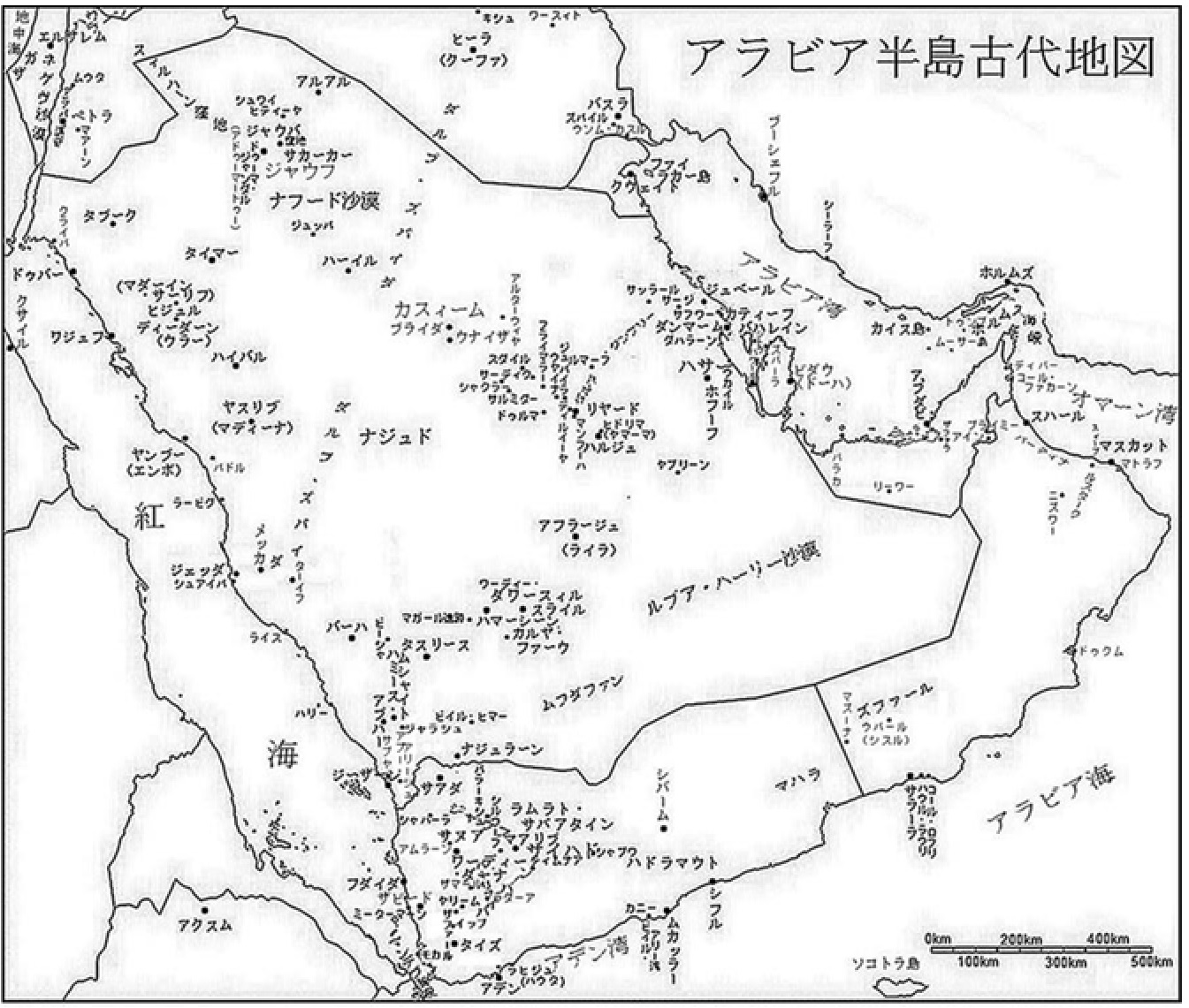
アラビア半島の古代地図 (Ancient Map of Arabian Peninsula)
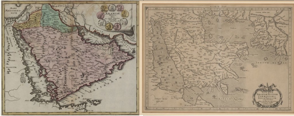
Ancient Maps presented by the Library of Congress of USAは「図書館は、知的で創造的な努力に情報を与え、刺激し、関与させるための豊富で多様で永続的な知識の源を保存し、それらへのアクセスを提供します。 」としてウェブに掲載されています。ここでは、その紹介にとどめますので詳細図は、「https://www.loc.gov/resource/gdcwdl.wdl_02923/?r=-0.239,-0.113,1.969,0.921,0」および「https://www.loc.gov/resource/gdcwdl.wdl_17584/?r=-0.128,0.07,1.228,0.574,0」を参照してください。
Ancient Maps presented by the Library of Congress of USA are published on the web as “The Library preserves and provides access to a rich, diverse and enduring source of knowledge to inform, inspire and engage you in your intellectual and creative endeavors.” . Here, the writer will only introduce them. As to the details, please referred to the followings; https://www.loc.gov/resource/gdcwdl.wdl_02923/?r=-0.239,-0.113,1.969,0.921,0 and https://www.loc.gov/resource/gdcwdl.wdl_17584/?r=-0.128,0.07,1.228,0.574,0 .
