6.5 Places related to dunes


目次
Contents
1 砂丘地帯に関係する地名一覧
1 List of Places related to dune areas
| 1 アリード | العريض | 1 Al ’Arid plain |
| 2 アルマ崖地 (ウルマ崖地) | العرمة | 2 ‘Armah Escarpment (‘Urumah Escapment) |
| 3 アフダル山塊 | الجبل الأخضر | 3 Jabal Akhdar |
| 4 涸れ谷スライイ | وادي السليّ | 4 Wadi as-Sulayy (Sulai) |
| 5 ギーラーナ | الغيلانة | 5 Ghiylanah |
| 6 クルカーラ湖 | القرقارة | 6 Qurqarah lake |
| 7 サブハ・マッティー | سبخة مطي | 7 Sabkha Mutti |
| 8 サラーラ | صلالة | 8 Salalah |
| 9ジダット・アル=ハラシース | جدة الحراسيس | 9 Jiddat al Harasis |
| 10 シャルーラ | شرورة | 10 Sharourah |
| 11 ジュバイル崖地 | جبيل | 11 Jubayl Escarpment |
| 12 ダファラ | الظفرة | 12 Dhafara Region |
| 13ダハル・ヒート | دحل هيت | 13 Dahl Hit (Ain Hit) |
| 14 ハラド | حرض | 14 Haradh |
| 15 ハルジュ | خرج | 15 Kharj |
| 16 ハルヒール(ヒルヒール) | الخرخير | 16 Kharkhir (Khirkhir) |
| 17 ビイル・ヒマー | بئر حمى | 17 Bir Hima |
| 18 ブワイブ崖地 | خندق بويب | 18 Buwayb Escarpment |
| 19 ヤマーマ | اليمامة | 19 Yamamah Region |
| 20 ライラ | ليلى | 20 Layla |
| 21 ラウダ・フライム | روضة خريم | 21 Rawdhat Khuraym |
| 22 ランヤ | رنية | 22 Ranyah |
2 地名の位置図
2 Location Maps of Places
2.1 アラビア半島砂丘地帯での位置図
2.1 Locations in Dune Areas of Arabian Peninsula
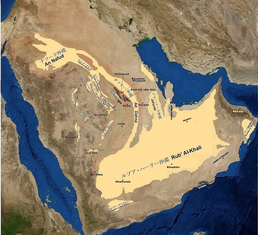
Drawn by Takahashi
2.2 アラビア半島中部拡大図
2.2 Enlarged Map of Central Arabian Peninsula
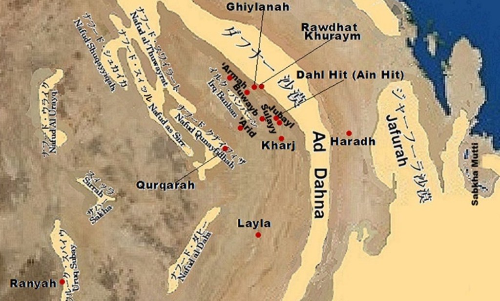
Drawn by Takahashi
2.3 アラビア半島南部拡大図
2.3 Enlarged Map of Southern Arabian Peninsula
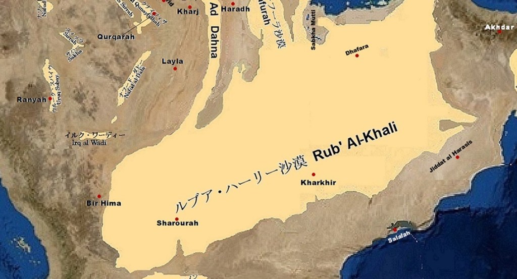
Drawn by Takahashi
2.4 ヤマーマ地方
2.4 Al-Yamama Region
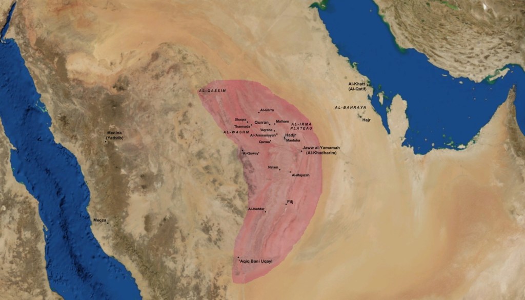
Al Yamama (Wikipedia)
3 砂丘地帯に関係する地名の説明
3 Descriptions of Places related to dune areas
3. 1 アリード
3. 1 Al ’Arid plain
| ナジュド地方中央部北の中核地帯で、トゥワイク山脈(جبال طويق)の台地からとアルマ崖地・ジュバイル崖地へと続く広く緩やかな谷間を含む大平原です。 | Central part of northern Najd region is a wide plain with gentle valleys stretching from Jebel Tuwaiq (جبال طويق) plateau to Armah and Jubayl escarpments. |
| トゥワイク山脈側にはワディ・ハニーファ(وادي حنيفة)が、アルマ・ジュバイル両崖地側にはワディ・スライイが南南東へと流れて、豊かな耕作地を作り出してきました。特にワディ・ハニーファの下流がワディ・ニサーフ(وادي نساح)と合流する手前は特に定住に適したようです。 | Wadi Hanifa (وادي حنيفة) lies on Jebel Tuwaiq side, while Wadi Sulayy flows on Armah–Jubayl side. These wadis run south-southeast and have created fertile farming lands. Area near confluence, where Wadi Hanifa meets Wadi Nisah (وادي نساح), seems especially suitable for settlement. |
| この平原には昔からジュバイラ(الجبيلة)、ウヤイナ(عيينة)、ディルイーヤ(الدرعية)、マンフーハ(منفوحة)およびリヤード(رياض)などのオアシス(واحة)集落が営まれてきました。イスラーム(الإسلام)以前は、ワディ・ニサーフ下流域のハルジュと合わせてヤマーマ(اليمامة)として知られていました。 | This plain has long had oasis (واحة) villages such as Jubailah (الجبيلة), Uyaynah (عيينة), Diraiyah (الدرعية), Manfuhah (منفوحة), and Riyadh (رياض). Before Islam (الإسلام), together with Kharj in lower Wadi Nisah basin, this area was known as Yamamah (اليمامة). |
3.2 アルマ崖地(ウルマ崖地)
3. 2 ‘Armah Escarpment (‘Urumah Escapment)
| (ウルマ崖地とも転写されています。)アラビア半島の脊稜とも呼ばれるトゥワイク山脈の東西両側には同じ様な断層崖が幾つかほぼ平行に並んでいます。 | (It is also transcribed as ‘Urumah Escarpment.) Several similar fault scarps are arranged almost in parallel on both east and west sides of Jebel Tuwaiq (جبال طويق), which is called spinal ridge of Arabian Peninsula. |
| その中でもリヤード北北西100km付近を中央としてトゥワイク山脈と対峙してダフナー沙漠(الدهناء)との間を北西から南東に横たわる崖地が、アルマ崖地です。 | Among them, ‘Armah Escarpment stretches northwest to southeast between Jebel Tuwaiq and Ad Dahna desert (الدهناء), centered about 100 km north-northwest of Riyadh. |
| アルマ崖地の北部では涸れ谷アトク(وادي العتك)が貫通してダフナー沙漠へと流れています。アルマ崖地からは南南東へと、ハルジュ方面にジュバイル崖地やダハル・ヒートが連なっています。 | In northern part of ‘Armah Escarpment, Wadi ‘Atk (وادي العتك) cuts through and flows toward Ad Dahna desert. From Armah Escarpment to south-southeast, Jubayl Escarpment and Dahl Hit continue in direction of Kharj. |
| トゥワイク山脈(Jebel Tuwaiq)とこの一連の崖地に挟まれた平地が、アリード地方と呼ばれ、平地東の崖地側には涸れ谷スライイ、平地西のトゥワイク山脈側には涸れ谷ハニーファがそれぞれにハルジュ方面に流れています。このため、アリード地方では水に恵まれ、古代から農業が広く営まれてきました。 | Flat land between Jebel Tuwaiq and this series of escarpments is called Al ‘Arid region. On eastern side of this plain, Wadi Sulayy flows toward Kharj, while on western side, Wadi Hanifa flows in same direction. Because of these wadis, Al ‘Arid region has been rich in water, and agriculture has been widely practiced since ancient times. |
3. 3 アフダル山塊
3. 3 Jabal Akhdar
| オマーンのハジャル山脈の最高峰で、緑の山とも名付けられています。 | It is the highest peak of Hajar mountains in Oman, also called Green Mountain. |
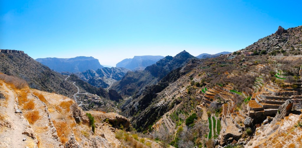
Terraces in Jebel Akhdar (Wikipedia)
3. 4 涸れ谷スライイ
3. 4 Wadi as-Sulayy (Sulai)
| アリード平原のアルマ崖地・ジュバイル崖地側を流れる涸れ谷です。 | It is a wadi flowing on Armah–Jubayl escarpments side of Al ’Arid plain. |
| リヤード東部を洪水から保護する天然の排水盆であり、現在は8つのレクリエーション区域や公園を設ける30ヵ年の大規模な環境開発計画が進められています。 | As a natural rainwater drainage basin protecting eastern Riyadh from floods, it is now subject to a massive 30-year environmental development master plan featuring eight recreational areas and parks. |
| ワディ・ハニーファとは合流せず、直接ハルジュへ流れると理解しています。 | It does not join Wadi Hanifa and flows directly toward Kharj. |
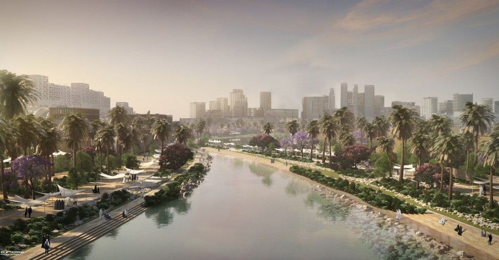
Explore works in Wadi As-Sulai (Dar Al-Handasah Shair and Partners)
3. 5 ギーラーナ
3. 5 Ghiylanah
| リヤード北北東115キロのルマーフ(رماح)南25キロにある集落で、ラウダ・フライム保護区への入り口になります。 | It is a village 115 km north-northeast of Riyadh and 25 km south of Rumah (رماح). Ghiylanah is gateway to Rawdhat Khuraym reserve. |
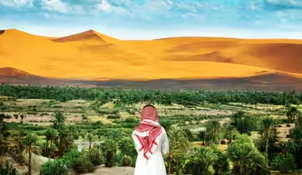
Al Ghiylanah Entrance of Rawdhat Khuraym) (Tiime of India)
3. 6 クルカーラ湖
3. 6 Qurqarah lake
| カララ湖とも呼ばれます。ニュー・メッカ・ロードと呼ばれるアラビア半島横断道路がトゥワイク山脈を西へ下ったナフード・クナイフザ(نفود قنيفذة)に在る町ムザーヒミーヤ(المزاحمية)と道路を挟んで反対側の砂丘群の中にあるサブハです。雨季の後に季節的な湖になります。 | Also called Khararah Lake, this sabkha becomes a seasonal lake after rains, lying among sand dunes opposite side of Muzahimiyah (المزاحمية) across New Mecca Road. Muzahimiyah, a town in Nafud Qunayfidhah (نفود قنيفذة), stands on desert plain west of Jebel Tuwaiq. |
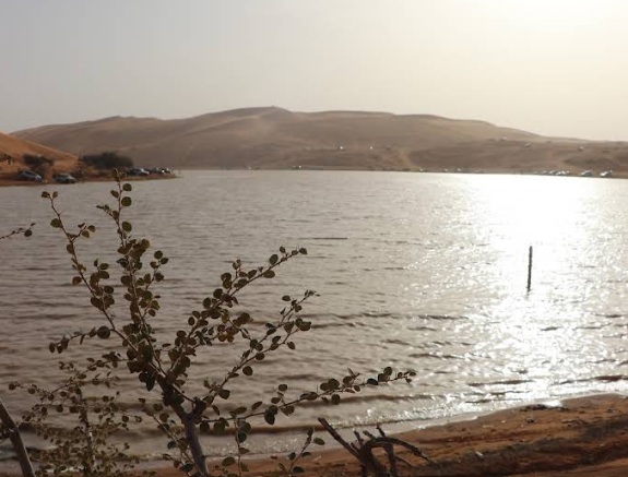
Qurqarah Lake (Google Maps)
3. 7 サブハ・マッティー
3. 7 Sabkha Mutti
| サブハ・マッティーはカタール半島付け根の東付近から内陸に延びるおおきなサブハです。詳しくは、「第8章 ルブア・ハーリー沙漠」を参照してください。 | Sabkha Mutti is a large sabkha extending inland from east side of base of Qatar Peninsula. For more details, see “Chapter 8 Rub’ al Khali Desert”. |
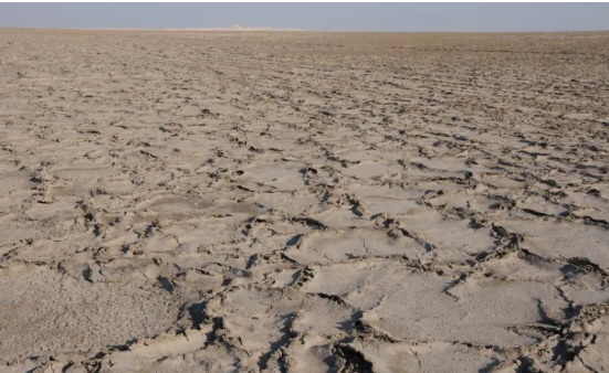
Polygonal salt crust at Matti surface (Saltwork Consultants).
3. 8 サラーラ
3. 8 Salalah
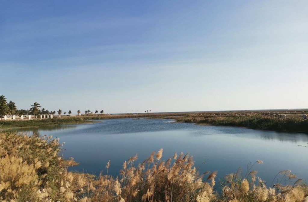
| オマーン南部のドファール州(محافظة ظفار)の州都です。人口は約20万人のオマーンでは3番目に大きな都市です。 | Salalah is capital of Dhofar Governorate (محافظة ظفار) in southern Oman. It is third largest city in Oman with population of about 200,000. |
| サラーラは、かつてのスルターン(سلطان)であったカーブース・ビン・サイード(قابوس بن سعيد)の誕生の地でもあります。 | Salalah is also birthplace of former Sultan (سلطان) Qaboos bin Said (قابوس بن سعيد). |
| アラビア海(بَحرُ ٱلْعَرَبْ)(に面し、北の後背地はカーラ山脈になっています。6月から9月にかけてのモンスーン(カリーフ(موسم الخريف))の恩恵で、カーラ山(جبل القرا)の南斜面から海岸まで、ココナッツやバナナなどの野菜や果物を栽培でき、市内にはたくさんの庭園があります。 | Salalah faces Arabian Sea (بَحرُ ٱلْعَرَبْ) and has northern hinterland of Qarah Mountains (جبل القرا). With grace of monsoon (Khareef) (موسم الخريف) from June to September, vegetables and fruits such as coconuts and bananas grow well, and many gardens spread from southern slopes of Qarah Mountains to coast of Arabian Sea. |
Salalah (Google Maps)
3. 9 ジダット・アル=ハラシース
3. 9 Jiddat al Harasis
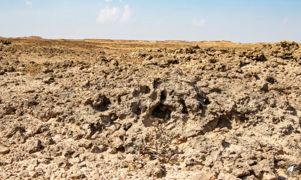
| ジダット・アル・ハラシースは、オマーンの南部の中央部に位置し、100〜150メートルの標高範囲で約27,000平方キロの面積に広がる石灰岩台地です。 | Jiddat al Harasis is a limestone plain in central southern Oman. It covers about 27,000 square kilometers with altitude between 100 and 150 m above sea level. |
| この地域は、ルブア・ハーリー沙漠東縁とハクフ砂丘帯の間に位置し、東に高さ100メートルの断崖があり、それに隣接してハクフの窪み(حقف منخفض)があります。 | This area lies between eastern margin of Rub’ al-Khali Desert and Huquf dune fields. To east stands a cliff about 100 meters high, adjacent to Huquf Depression (حقف منخفض). |
| この地域は、アラビア海とジャナーバ(الجنابة)丘陵の間でも縁取られており、高さは300メートルに上ります。 | This area also lies between Arabian Sea and Janabah (الجنابة) Hills, reaching up to 300 m altitude. |
| アラビア海はジダット・アル=ハラシースの東と南の境を形成しています。 地質は主に中新世のカルスト石灰岩です。 古い地質学的特徴には、年齢を考えるとよく保存されている3億年前の氷河の痕跡が含まれます。 | Arabian Sea forms eastern and southern border of Jiddat al Harasis. Geology is mainly Miocene karst limestone. Old features include traces of glaciers from 300 million years ago, well preserved for their age. |
| オマーンの南部の中央部に位置し、絶滅危惧種であるフサエリショウノガン(حبارى إفريقي)をふくむ160種を超える野鳥とアラビアオリックス(مهاة عربية)、アラビアガゼル(أعفر)がここに生息しています。19世紀のハーラーシース人(الهاراسيس)の到来までここに定住する人はいませんでした。 | In central southern Oman, more than 160 bird species live here, including endangered Houbara bustard (حبارى إفريقي). It is also habitat for Arabian oryx (مهاة عربية) and Arabian gazelle (أعفر). No people settled here until Harasis tribe (الهاراسيس) arrived in 19th century. |
Stone desert Jiddat Al Harasis in Oman (DreamsTime)
3.10 シャルーラ
3.10 Sharourah
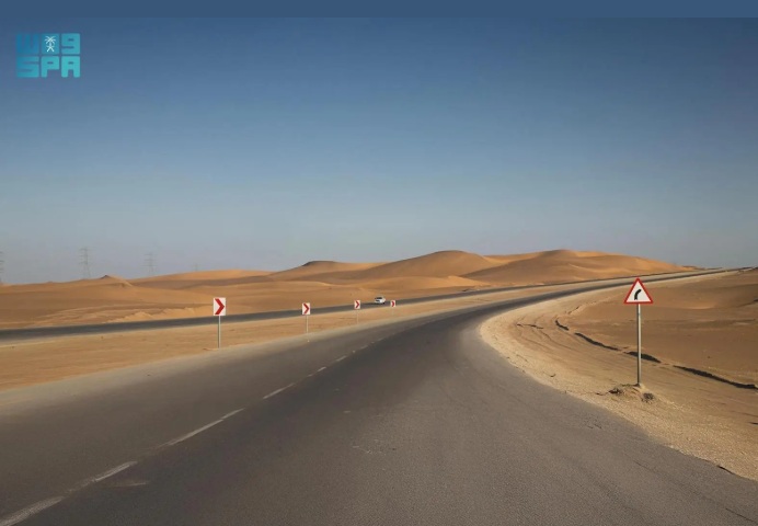
| ナジュラーンからイエメン国境に沿って東332キロメートル付近に元空軍基地の町シャルーラがあります。詳細は、「第8章 ルブア・ハーリー沙漠」を参照してください。 | Sharourah, A former air force base town, is about 332 km east of Najran along Yemen border. See “Chapter 8 Rub’ al Khali Desert” for more details. |
Sharurah (A Gateway to Empty Quarter by Saudi Press Agency)
3.11 ジュバイル崖地
3.11 Jubayl Escarpment
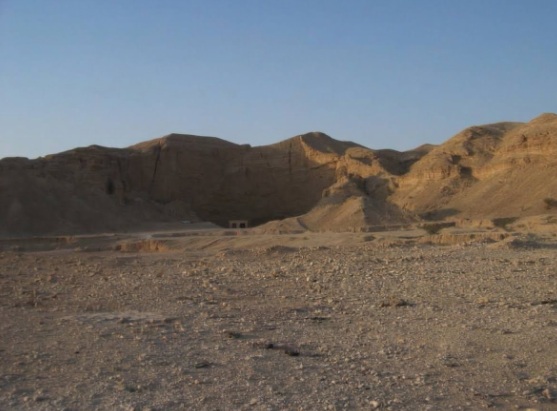
| ジュバイル崖地は、リヤードからハルジュへの高速道路の東にそびえています。その中間(リヤード南東35km、ハルジュ北西45km)には地底湖として知られていたアイン・ヒートがあります。 | Jubayl Escarpment rises east of Riyadh–Kharj highway. Near its center (35 km southeast of Riyadh, 45 km northwest of Kharj), there is Ain Hit (Dahl Hit), known as an underground lake. |
Entrance of Ain Hit on Jubayl Escarpment (Photo by Takahashi)
3.12 ダファラ
3.12 Dhafara Region
| シャイバー砂丘帯(عروق الشيبة)よりも西にある地域です。詳細は、「第8章 ルブア・ハーリー沙漠」を参照してください。 | Dhafara lies west of ʿUruq ash-Shaybah (عروق الشيبة). For more details, see “Chapter 8 Rubʿ al-Khali Desert.” |
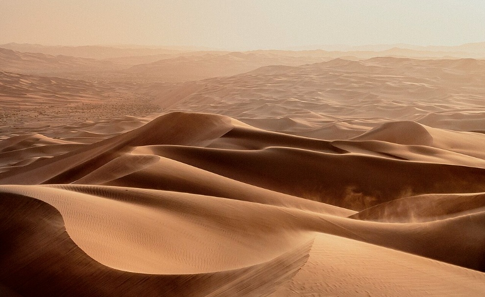
Desert Dunes of Dhafra Region, Abu Dhabi (Wikipedia)
3.13 ダハル・ヒート
3.13 Dahl Hit (Ain Hit)
| ダハル・ヒート(アイン・ヒートとも呼ばれる)は、リヤードの東南東約35kmにあるジュバイル崖地の鍾乳洞です。 | Dahl Hit (also known as Ain Hit) is a limestone cave in Jubayl Escarpment, about 35 km east-southeast of Riyadh. |
| ここでは、無水岩(Anhydrite)と呼ばれる蒸発岩(Evaporite)が地表に見られます。この真珠のような灰色の岩には、やや暗いシミがついています。このシミは1938年、ARAMCOの地質学者によってアラビア半島で初めて発見されたタールの痕跡であり、半島東部の油層を解明する重要な手がかりとなりました。 | On its surface, evaporite called anhydrite can be seen. This pearly gray rock has a slightly dark stain. In 1938, ARAMCO geologists found this stain as a tar mark. It was the first sign of oil discovered in Arabian Peninsula and became a key to understanding oil reservoirs in eastern Arabia. |
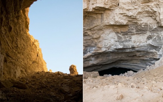
Entrance and Exit of Ain Hit (Photo by Takahashi)
3.14 ハラド
3.14 Haradh
| ハラドは、ダンマーム(دمام)の南250km、ハサー(حسا)の南142kmに位置し、かつてはダンマーム鉄道南線の信号所駅でした。 | Haradh was once a signal station on Dammam railway south line, located 250 km south of Dammam (دمام) and 142 km south of Al-Hasa (حسا). |
| 鉄道と並行する涸れ谷ワディ・サフバー(وادي السهباء)の河床には、ナショナル農業開発会社(NADEC)の円形農場が並んでいます。 | Wadi bed of Wadi as-Sahba (وادي السهباء), running parallel to railway, is lined with circular farms of NADEC, a national agricultural development company. |
| ハラドから東へ向かうと、カタール半島の付け根にあるアラブ首長国連邦との西国境に直接つながる舗装道路が完成しています。この道路は、1998年に生産が始まったルブア・ハーリー沙漠(الربع الخالي)北東部のシャイバー油田(حقل شيبة)への補給路の一部と考えられています。 | A paved road extends east from Haradh, directly connecting to west border of UAE at base of Qatar Peninsula. This road likely became part of supply route to Shaybah oil field (حقل شيبة) in northeastern Rubʿ al-Khali (الربع الخالي), where production began in 1998. |
| 2004年、サウジアラビア政府は、英シェル、露ルコイル、中シノペック、伊・西のエニ・レプソル連合と4つの合意書を締結し、計32.1万平方キロ(うち21万平方キロがシェル)に及ぶルブア・ハーリー沙漠北東部のガス利権区域の開発に乗り出しました。この開発でも、前述の道路が補給路の一部となっていたようです。 | In 2004, Saudi government signed four agreements with Shell (UK), Lukoil (Russia), Sinopec (China), and ENI-Repsol (Italy and Spain) to develop gas concession areas covering 321,000 square kilometers, including 210,000 under Shell. These areas span much of northeastern Rubʿ al-Khali. This road was likely used as part of supply route for that development too. |
| また、2004年夏には、アラムコのマスターガスシステムの一環として、ハラドにフッフ層(تشكيل الخف)から産出される非随伴性天然ガスを日量16億立方フィート処理するガスプラントが完成しました。このプラントでは、日量17万バレルのコンデンセートも生産しています。 | In summer 2004, a gas plant was completed in Haradh as part of ARAMCO’s Master Gas System. It processes 1.6 billion cubic feet per day of non-associated natural gas from Khuff Formation (تشكيل الخف), and also produces 170,000 barrels per day of condensates. |
| 現在、ハラドは石油・ガス産業を中心とした工業都市となっています。さらに南へ進むと、ウバイラ(العبيلة)を経てナジュラーン州(منطقة نجران)のハルヒール県へとつながる沙漠道路も整備されています。 | Today, Haradh has grown into an industrial city centered on oil and gas. A desert road also extends south, connecting to Kharkhir governorate in Najran region (منطقة نجران) via Ubaylah (العبيلة). |
| 詳しくは「第8章 ルブア・ハーリー沙漠」の「ハラド」に関する記述も参照してください。 | For more details, see “Haradh in Chapter 8 Rubʿ al-Khali Desert”. |
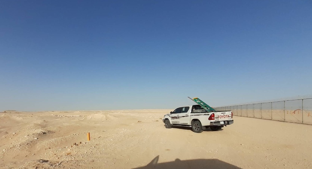
Haradh (Google Maps)
3.15 ハルジュ
3.15 Kharj
| ハルジュはリヤードの南東約80kmに広がるオアシスで、サウジアラビア国内では緑の象徴とされてきました。 涸れ谷サフバー(وادي السهباء)の三つの支流、涸れ谷ニサーフ(وادي نساح)、涸れ谷ハウタ(وادي حوطة)、涸れ谷ビルク(وادي البرك)は、それぞれリヤードの南約150kmの範囲でトゥワイク山脈を北から順に東西に横切り、ハルジュで合流します。また、トゥワイク山脈の東側を北から流れてくる涸れ谷ハニーファ(وادي حنيفة)は、ハルジュの上流で涸れ谷ニサーフに合流しています。 このように、いくつもの涸れ谷が集まることで、このオアシスには豊富な地表水が供給され、古くから豊かな緑が育まれてきました。この地に「鞍袋」という意味の名前がつけられたのも、こうしたオアシスの形に由来しているのかもしれません。 | Kharj is an oasis about 80 kilometers southeast of Riyadh. It has long been a symbol of greenery in Saudi Arabia. Three tributaries of Wadi as-Sahba—Wadi Nissah (وادي نساح), Wadi Hawtah (وادي حوطة), and Wadi Birk (وادي البرك)—cut through Jebel Tuwaiq from west to east within about 150 kilometers south of Riyadh. These streams meet at Kharj. Wadi Hanifah (وادي حنيفة), flowing from north along eastern side of Jebel Tuwaiq, joins Wadi Nissah upstream of Kharj. Because of this, this oasis receives abundant surface water, allowing rich greenery to flourish since ancient times. This oasis’s name “Kharj,” meaning “saddlebag,” may come from its shape where several wadis come together. |
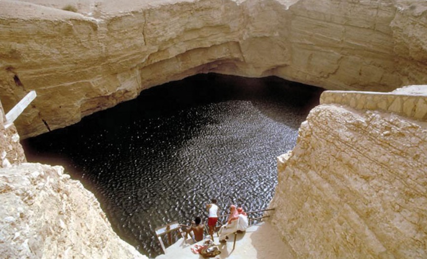
Wells of Al Kharj (February 26, 2023, Destination KSA)
3.16 ハルヒール(ヒルヒール)
3.16 Kharkhir (Khirkhir)
| ハルヒールは、ルブア・ハーリー沙漠の北緯19度・東経51度付近に位置する水井戸のあるイエメン国境の村です。 詳しくは「第8章 ルブア・ハーリー沙漠」の記述も参照してください。 | Kharkhir is a village near Yemeni border with a water well. It is located around 19° north latitude and 51° east longitude in Rubʿ al-Khali Desert. For more details, see “Chapter 8 Rubʿ al-Khali Desert.” |
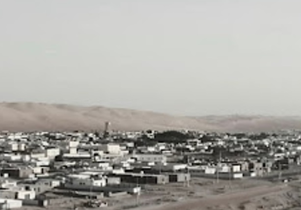
Kharkhir (Khirkhir) (Google Maps)
3.17 ビイル・ヒマー
3.17 Bir Hima
| ビイル・ヒマーは、ナジュラーン市の北北東約85kmに位置しています。 | Bir Hima is about 85 kilometers north-northeast of Najran. |
| その北に広がる岩壁画や碑文の谷々を訪れる際の入り口であり、給油・給水やタイヤの空気調整を行う場所でした。 | It was a gateway to valleys filled with rock art and inscriptions spreading to north. Travelers used to refuel, get water, and adjust tire pressure there. |
| これらの谷には、旧石器時代・新石器時代・鉄器時代の遺跡が残されています。岩壁画や碑文は非常に見事で、1951年にフィルビーらによって行われた探査の測量跡も今なお残っています。 | Ruins from Paleolithic, Neolithic, and Iron Age remain in these valleys. Rock images and inscriptions are especially marvelous. Survey marks from 1951 exploration by St. John Philby and others in Philby–Ryckmans–Lippen expedition can still be seen. |
| その後も調査が続けられ、2021年にはヒマ文化圏としてユネスコ世界遺産に登録されました。 | After many investigations, these valleys were registered in 2021 as a UNESCO World Heritage Site under Hima cultural area. |
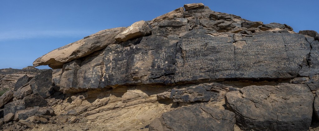
Bir Hima (Wikipedia)
3.18 ブワイブ崖地
3.18 Buwayb Escarpment
| ブワイブ崖地は、リヤードの北85kmに位置し、ウルマ崖地の続きにあたります。 | Buwayb Escarpment is located about 85 km north of Riyadh and is a continuation of Urumah Escarpment. |
3.19 ヤマーマ
3.19 Yamamah Region
| ナジュド(نجد)台地東部の古代名ヤマーマは、イスラーム以前には、アリード(العريض)とハルジュの耕作地全体を指していました。 | Ancient name Yamamah in eastern Najd (نجد) Plateau once referred to all cultivated lands of Al Arid (العريض) and Kharj before Islam. |
| アラブの伝説には、失われた部族であるタスム族(طسم)とジャディース族(جديس)の開拓と耕作の物語があります。両部族は西暦300年以前のある時期に、ナジュド地方の中央からやや北寄りにあるアリードとハルジュを開墾し、繁栄していました | Arab legends tell stories of two lost tribes, Tasm (طسم) and Jadis (جديس), who prospered as farmers by clearing lands in Al Arid and Kharj, slightly north of central Najd, sometime before 300 AD. |
| ジャディース族は、「落ち込んだ平地」や「涸れ谷の谷底」を意味するジャウウ(جو)を都としました。一方、タスム族は、涸れ谷バトハー(وادي البطحاء)(現在のリヤード市内)にあるハジュル(حجر)を都としました。タスム族の専制的な君主の傲慢な振る舞いにより、両部族の間に不和が生じ、ヒムヤル王国(مملكة الحمير)の干渉を招いてしまいました。 | Jadis made Jaww (جو) their capital, named for its meaning “depressed plain” or “bottom of a wadi.” Tasm chose Hajr in Wadi al-Batha (وادي البطحاء), now part of Riyadh, as their capital. Arrogant rule by Tasm’s kings led to conflict between the tribes and eventually drew interference from Himyar Kingdom (مملكة الحمير). |
| その間、ジャウウのジャディース族は、女預言者ザールカー・ヤマーマ(زرقاء اليمامة)の警告を無視したため、ヒムヤル王国に攻め込まれ、町は破壊されました。その際、女預言者は十字架にかけられ、遺体はジャウウの城門に晒されました。 | Jadis in Jaww ignored warnings from their female prophet Zarqa al-Yamamah (زرقاء اليمامة) and were attacked by Himyarites. Their town was destroyed, and the prophet was crucified, her body displayed at Jaww’s gate. |
| 後にジャウウは、この女預言者に因んでジャウウ・ヤマーマ(جو اليمامة)と呼ばれるようになり、やがてその名がこの一帯全体を示す「ヤマーマ」となりました。ハジュルも「ハジュル・ヤマーマ(حجر اليمامة)」と呼ばれるようになりました。 | Later, Jaww was renamed Jaww Yamamah (جو اليمامة) in her honor. Over time, Yamamah came to refer to the entire region, and Hajr (حجر) became known as Hajr Yamamah (حجر اليمامة). |
| 5世紀のある時期にこの地に到来したバヌー・ハニーファ族(بنو حنيفة)は、かつて繁栄し、すでに滅びたタスム族とジャディース族の廃墟となった集落(ハジュルを含む)を発見し、そこに定住しました。このことにより「ヤマーマ」という名が定着し、後の歴史的繁栄の始まりとなりました。 | In 5th century, Banu Hanifa (بنو حنيفة) arrived and found abandoned settlements of Tasm and Jadis, including Hajr. They settled there, and the name Yamamah became established, marking the beginning of the region’s later prosperity. |
| 現在、リヤードではヤマーマの名がバトハー(البطحاء)の地区名として残っており、ヤマーマ宮殿(قصر اليمامة)など、ヤマーマの名は広く使われています。一方、ジャウウは現在のハルジュのヒドリマ(الخضرمة)にあたり、ヤマーマの地区名として今も残っています。 | Today in Riyadh, Yamamah remains as a district name in Batha (البطحاء), and is widely used, including in Yamamah Palace (قصر اليمامة). Jaww is now Khidrimah (الخضرمة) in Kharj, still part of Yamamah region. |
3.20 ライラ
3.20 Layla
| ライラは、リヤードの南300km、スライル(السليل)の北北東204kmに位置しています。 | Layla is located 300 km south of Riyadh and 204 km north-northeast of Sulayyil (السليل). |
| ウィリアム・フェイシーは、「ライラは涸れ谷ハダール(وادي حدار)(現在のワディ・アフマル(وادي الأحمر)沿いの農村であり、古代からアフラージュ(أفلاج)と呼ばれてきました。これは地下水路カーレーズ(كاريز)を意味するアラビア語である」と述べています。 | William Facey wrote, “It is a rural village along Wadi Haddar (وادي حدار), now called Wadi al-Ahmar (وادي الأحمر), and has long been known as Aflaj (أفلاج), Arabic word for karez (كاريز).” |
| 詳細は「第8章ルブア・ハーリー沙漠」を参照してください。 | For more details, see “Chapter 8 Rubʿ al-Khali Desert.” |
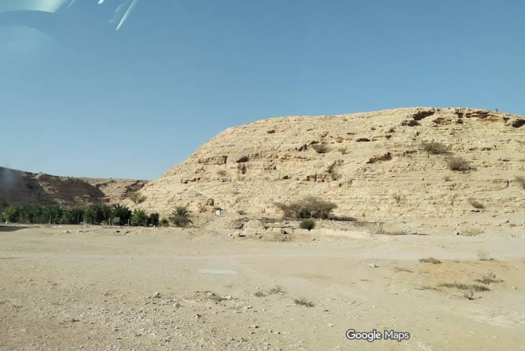
Layla (Google Maps)
3.21 ラウダ・フライム
3.21 Rawdhat Khuraym
| ラウダ・フライムは、ルマーフ(رماح)の南25km、ギイラーナとダフナー砂漠の間に設けられた緑地帯の公園で、周囲は約120kmあります。ルマーフはリヤード州の一つの県で、首都リヤードの北東約120kmに位置しています。 | Rawdhat Khuraym is a green park located between Ghiylanah and Ad Dahna desert, about 25 km south of Rumah (رماح), with a circumference of around 120 km. Rumah is a governorate in Riyadh Province, about 120 km northeast of Riyadh. |
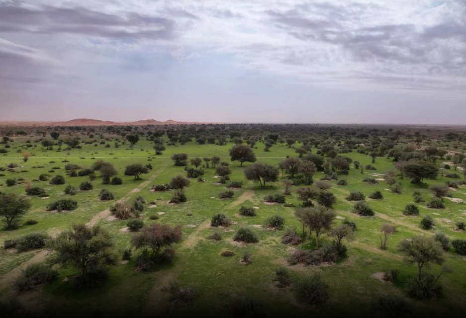
Rawdat Khuraim (Saudipedia)
3.22 ランヤ
3.22 Ranyah
| ランヤは、メッカ州(منطقة مكة)東部、涸れ谷ランヤ(وادي رنية)の下流域にある町で、ターイフ(طائف)の東約250kmに位置しています。 | Ranyah is a town in lower reaches of Wadi Ranyah (وادي رنية), about 250 km east of Taif (طائف), in eastern Makkah Province (منطقة مكة). |
| 「喜び」という意味を含むこの町の名は、魅力的な女性の名前としても使われ、化粧品のブランド名になっていたり、ハーレム(هارلم)を舞台にした物語にも登場したりします。元キャリアウーマンで、高貴な美しさと洗練された感性、知性を持つヨルダン(الأردن)のラーニア王妃(رانيا العبد الله)の名前も、同じ語源を持つといわれています。 | Its name, which includes meaning of “joy,” is also used as a name for charming women. It appears in cosmetic brand names and in stories set in Harlem (هارلم). Queen Rania (رانيا العبد الله) of Jordan (الأردن), a former career woman known for her noble beauty, refined sense, and intelligence, is said to share this same name origin. |
| また、日本の「松下ガイアテクノ」という会社が「ニュー・ブルー」という商品名で紹介している、美しい淡いエメラルドグリーン色の御影石などの石材も、ランヤ近郊で産出されています。 | In addition, a Japanese company called Matsushita Gaia Techno has introduced stone materials near Ranyah, including a beautiful pale emerald green granite sold under the product name “New Blue.” |
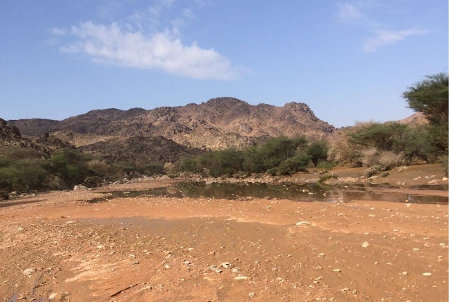
Ranyah (Google Maps)

