
Unique terrains and locations of the Rub’ al Khali


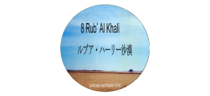
ルブア・ハーリー沙漠の特異な地形や場所の一覧
List of Unique terrains and locations of the Rub ’al Khali
| アラダ崖地 | جرف عردة | Aradh Escarpment |
| ウンム・ハディダ窪地 | أم الحديدة | Umm al-Hadidah craters |
| カドカーダ | القضقاضة | Al Qadqadah |
| サブハ・ハマー | سبخة الحمر | Sabkhat Al Hammar |
| サブハ・マッティー | سبخة مطي | Sabkha Matti |
| ジダット・アル・ハラシース | جدة الحراسيس | Jiddat al-Harasis |
| ジリダ | خشم كمدة | Jilida |
| ハシュム・クムダ | خشم كمدة | Khashm al Kumdah |
| ハシュム・グラーブ | خشم غراب | Khashm Ghurab |
| ハシュム・ハヤール | خشم غراب | Khashm al Hayyal |
| ワバール窪地 | فوهة الوابر | Wabar Crater |
ルブア・ハーリー沙漠の特異な地形や場所の説明
Descriptions for Unique terrains and locations of the Rub ’al Khali
| アラダ崖地 | Aradh Escarpment |
| ルブア・ハーリー沙漠南西部で、南の砂丘地帯まで長く延びる石灰岩崖地をウィルフレッド・セシジャーは、アラド(Aradh)と呼んでいました。この崖地は、アラビア半島の脊稜トゥワイク山脈がシャイーブ・ファーウ(涸れ谷ヒンウ上流部)より南の部分では、狭く細くなっているために山脈ではなく、崖地と呼ばれていると考えています。この崖地は、ハシュム・グラーブ多少、東向きになった後、砂の中に消えています。 | The southwestern Rub’ al Khali is bordered its western side with an uplifted limestone escarpment. It is a south extension of the Jebel Tuwayq, which constitutes the spine of the Arabian Peninsula. Its southern part from Sha’ib al Faw (upstream of Wadi al Hinw) is so narrow that it is called an escarpment rather than a mountain range. It turns slightly eastward further south of Khashm Ghurab and then disappears into vague sand. Wilfred Thesiger called it Aradh Escarpment. |
| ウンム・ハディダ窪地 | Umm al-Hadidah craters |
| フィルビーがその著書「ルブア・ハーリー沙漠」(1933年出版)に記述していた「1863年または1891年に発生し、南東に向かっているとさまざまに報告され、リヤドを通過した火の玉」については、ワバール窪地の北西25 キロのウンム・ハディダ窪地「鉄の母」に衝突した鉄隕石であると特定されています。(ワバール窪地を参照してください。) | St John Philby published his book “Rub ‘al Khali” in 1933, describing the Rub’ al Khali he investigated. In the book, St John Philby also mentions “a fireball that occurred in 1863 or 1891 and was reportedly heading southeast and passed through Riyadh.” This fireball is now identified as an iron meteorite that collided with Umm al-Hadidah craters “Mother of Iron in Arabic” 25 kilometers northwest of Wabar crater. (See Wabar crater for more details.) |
| カドカーダ | Al Qadqadah |
| アシールから空白へと流れて出た涸れ谷ハブーナの古い河床は、小さな玉石や砂利の原を意味するカドカーダと呼ばれています。この涸れ谷の上流域のアシール山中には今日でも大きなタマリスク(ギョリュウ)の群生があります。 | The old riverbed of the Wadi Habunah, which flows from the Asir mountains to the Rub’ al Khali, is called Al Qadqadah, which means a field of small boulders and gravels. In the upper reaches of this wadi valley, there are still large Tamarisk colonies today. Such richness of the Wadi Habunah might be related to make Al Qadqadah. |
| サブハ・ハマー | Sabkhat Al Hammar |
| 涸れ谷サフバーの河口域で、サブハ・マッティー(Sabkha Mutti)の西30キロ、バサ南30キロに広がるサブハです。 | It is the sabkha that spreads 30 kilometers west of Sabkha Mutti, and 30 kilometers south of Al Batha located in the estuary of the Wadi as-Sahba. |
| サブハ・マッティー | Sabkha Matti |
| サブハ・マッティーはアラビア湾岸のアラブ首長国連邦とサウジアラビアのカタールに近い国境地帯にあり、涸れ谷サフバーが流れ込んでいます。マテイーの意味はイラクでは驢馬ですが、このサブハは思ったよりずうっと内陸まで入り込んでいる為にこの地域のベドウインはゴムの様に伸びると云う意味に使っているようです。 | Sabkha Matti spreads the border area near Qatar between United Arab Emirates and Saudi Arabia on the Arabian Gulf Coast. It also occupies the estuary of the Wadi as-Sahba. Matti means donkey in Iraq, but because this Sabkha expands far inland, Bedouin in this area uses it to mean that it stretches like rubber. |
| ジダット・アル・ハラシース | Jiddat al-Harasis |
| ジダット・アル・ハラシースは、オマーンの南部の中央部に位置し、100〜150メートルの標高範囲で約27,000平方キロメートルの面積に広がる石灰岩台地です。詳細は「6 砂丘地帯」を参照してください。 | Jiddat al-Harasis is a limestone plateau located in the southern Oman central, covering approximately 27,000 square kilometers over 100 ~ 150 meters altitude. See “6 Dunes” for more information. |
| ジリダ | Jilida |
| 涸れ谷ハブーナが空白地帯へと流れ込んで、形成されたのがカドカーダであり、ジリダはカドカーダのさらに下流域となります。平原ジリダでは風で磨かれた流紋岩、斑岩、碧玉や花崗岩の欠片が礫岩の上を覆う固い砂の中にモザイック模様を作り出しています。 | Wadi Habunah flowed into the Rub’ al Khali, and formed Al Qadqadah. Jilida is further downstream of Al Qadqadah. In ex-riverbed Jilida, wind had polished the fragments of rhyolite, porphyry, jasper, granite, etc., and created a mosaic pattern in hard sand overlying gravel bed. |
| ハシュム・クムダ | Khashm al Kumdah |
| トゥワイク山脈を涸れ谷ダワースィルが切り通した南側の崖の端で、東から西へハシュム・クムダとハシュム・カザフが並んでいます。 | Khashm al Kumdah and Khashm al Kazafu line up on the southern cliff edge from east to west. This cliff was formed by the Wadi al Dawasir, that cut through the Jebel Tuwaiq and had streamed to east. |
| ハシュム・グラーブ | Khashm Ghurab |
| 涸れ谷ダワースィル地方グバイシュ丁字路南180キロにある二叉分岐スルターナ東のピークです。道路は、この二叉分岐でルブア・ハーリー沙漠南部の軍事都市シャルーラへの道ととナジュラーンへの道に分かれます。 | Khashm Ghurab is the peak east of the forked point “Sultanah”. The forked point “Sultanah” is 180 kilometers south of the junction “Ghubaish” in the Wadi al Dawasir region. There, the road divides into a road to Sharourah and a road to Najran. |
| ハシュム・ハヤール | Khashm al Hayyal |
| トゥワイク山脈をカルヤ・ファーウで、涸れ谷ヒンウの上流部シャイーブ・ファーウが切り通した山脈南部分(アラダ崖地)の北の端です。 | Khashm al Hayyal is the peak on the cliff at the northern edge of the Aradh Escarpment. The Ardh Escarpmentt is the southern part of the Jebel Tuwaiq that Sha’ib al Faw cut through. The Aradh Escarpment extends south from there. |
| ワバール窪地 | Wabar Crater (فوهة الوابر) |
| 1932年2月に謎の都ウバールを探索していたSt.ジョン・フィルビーは、音訳でワバールと理解していたので、ベドウィンの伝説に鉄の場所(ハディダ)と呼ばれていた古代の住居遺跡がウバールと考えて、そこに遠征しました。過酷な沙漠の長い旅の後、ウバールは見つけられませんでしたが、白い砂岩、黒いガラス、鉄隕石が散乱し、5 つ隕石衝突窪地のある広大な隕石衝突跡を発見しました。St.ジョン・フィルビー自身は火口であると考えていましたが、英国に持ち帰った岩石資料の大英博物館による分析よって、隕石衝突跡であると、後に判明しています。フィルビーは、詳細をその著書「ルブア・ハーリー沙漠」(1933年出版)に記述しています。その後、1937年にAramco、1966年にAramcoとNational Geographic、1982に再び Aramcoおよび1944~1955年にZahid Tractorが後援したDr. Jeffrey C. Wynnによる調査等が行われてきました。2.2 tonsもの巨大な鉄隕石は、現在、国立博物館(に展示されています。 (ウンム・ハディダも参照してください。) | St John Philby, who was exploring the mysterious city of Ubar in February 1932. St John Philby believed that Ubar was Wabar in transliteration, so that he had explored the legendary ancient dwelling sites called Iron Place (Al Hadida) by bedouins. In spite of a long journey through a harsh desert, St John Philby had not been able to find Ubar, but he found the site scattered with white sandstone, black impactite, and iron meteorite. It is a vast meteorite impact area with five Meteorite craters. St John Philby himself thought that it was a crater, but later revealed it is a meteorite impact area through the British museum’s analysis on rock materials brought back to England. St John Philby describes these details in his book “Rub’ al Khali” (published in 1933). After that, Aramco in 1937, Aramco and National Geographic in 1966, and again in 1982, this site was investigated mainly by Aramco. Thomas. J. Abercrombi, National Geographic, found and brought back a huge iron meteorite of 2.2 tons. It is currently displayed at the National Museum of Saudi Arabia. Then, Dr. Jeffrey C. Wynn investigated under sponsorship of Zahid Tractor from 1944 to 1955. (See also Umm al-Hadidah.) |
